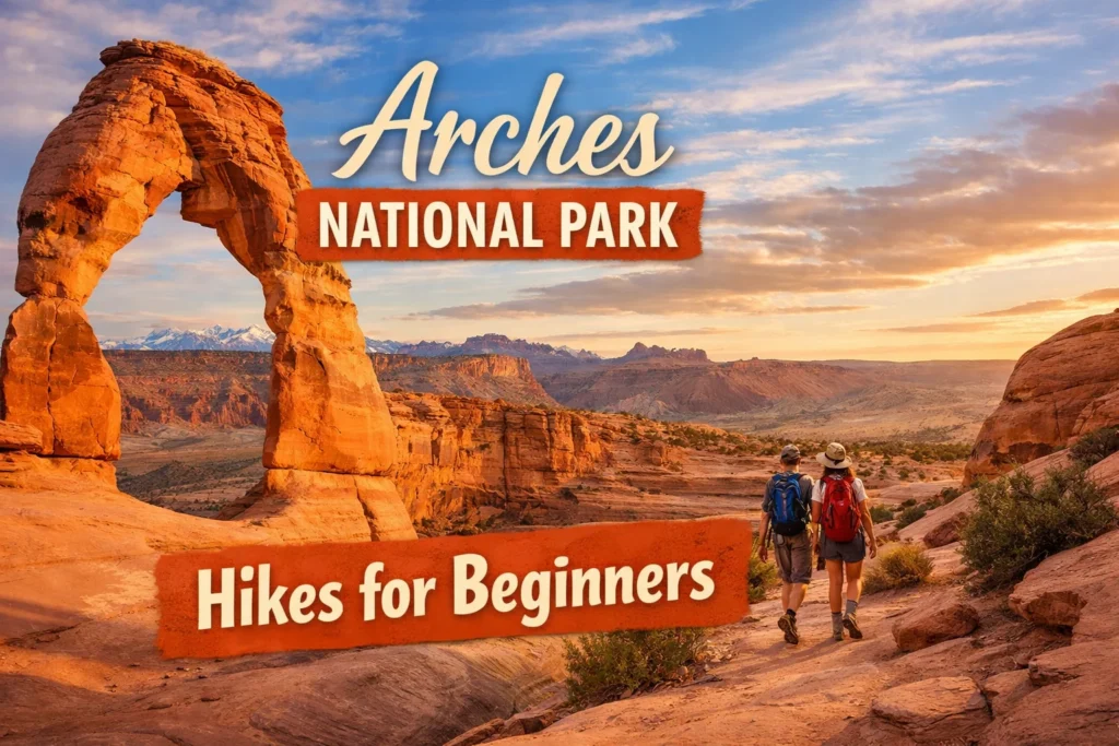
Easy Hikes in Arches National Park: 10 Beginner-Friendly Trails with Maps, Distance & Tips (2026)
Most of what makes Arches National Park famous doesn’t require a difficult hike to reach. Nine of the ten trails below are under two miles round trip, several are flat enough for strollers, and one is fully paved. The one exception — the trail to Delicate Arch itself — gets a clear warning below, because it’s routinely mislabeled as “easy” when it isn’t.
What Actually Counts as “Easy” Here
Arches rates its own trails on a three-tier scale: easy, moderate, and strenuous. “Easy” at Arches generally means a defined, mostly flat path with minimal elevation change, though a few trails on this list have short sections of rock stairs or a bit of loose sand that can slow down young kids or anyone with mobility concerns. None of these require scrambling, exposed ledges, or route-finding skills.
One trail deserves a specific callout before the list starts: the hike to the base of Delicate Arch — the freestanding arch on Utah’s license plate — is a 3-mile round trip on exposed slickrock with a real elevation gain and no shade. The National Park Service classifies it as moderate to strenuous, not easy. If you want to see Delicate Arch without that climb, two viewpoint trails get you a view of it in under a mile combined, and they’re covered further down.
If you are planning then check this guide also: Arches National Park Tickets & Timings Guide 2026
Quick Reference
| Trail | Round Trip Distance | Difficulty | Stroller/Wheelchair Friendly |
|---|---|---|---|
| Park Avenue Viewpoint | Under 0.2 miles | Easy | Yes (viewpoint only) |
| The Windows (North & South) | About 1 mile | Easy | First 100 yards only |
| Double Arch | About 0.5 miles | Easy | No (sandy) |
| Balanced Rock Loop | 0.3 miles | Easy | Yes |
| Delicate Arch Lower Viewpoint | Under 0.2 miles | Easy | Yes |
| Delicate Arch Upper Viewpoint | About 0.5 miles | Easy | No (some incline) |
| Sand Dune Arch | 0.3 miles | Easy | No (deep sand) |
| Broken Arch | Roughly 1.2 miles | Easy | No |
| Skyline Arch | 0.4 miles | Easy | No |
| Landscape Arch | Roughly 1.6–2 miles | Easy | No |
Exact posted mileage varies slightly between the park’s printed map, trailhead signs, and the NPS app, so treat the numbers above as close estimates rather than exact figures — pick up a current park map at the visitor center or check the NPS app before you go if precision matters to your planning.
Do You Need a Reservation to Enter?
As of February 2026, Arches is not requiring timed-entry reservations. The park ran a mandatory reservation system in prior years, but a February 18, 2026 announcement from the park removed that requirement, and visitors can currently enter at any time during operating hours with a valid entrance pass. That said, the park has kept the door open to reinstating some form of entry management if summer crowding overwhelms the parking-based approach it’s using instead, so it’s worth checking the alerts page on the park’s official website (nps.gov/arch) shortly before your visit rather than assuming the current rule will still apply months from now.
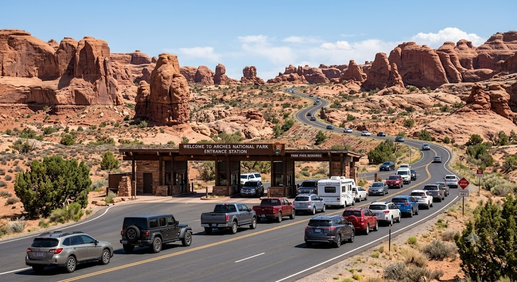
A standard vehicle pass costs $30 and covers seven consecutive days. What hasn’t changed is what happens when trailhead parking fills up: rangers can and do temporarily close access to specific lots — the Windows section and Devils Garden trailhead fill first — until space opens back up. Those closures have lasted several hours during peak periods. Arriving before 8 a.m. or after 4 p.m. is the most reliable way to avoid this, especially between May and October.
Park Avenue Viewpoint – Fastest Stop for First-Time Visitors
This is usually the first stop after the entrance station, and it’s less a hike than a short walk to a dramatic overlook. From the viewpoint you’re looking down a canyon lined with tall rock fins that early visitors nicknamed for their resemblance to a city skyline. The full Park Avenue Trail continues one direction down into the canyon and comes out at a second parking area about a mile away, which turns it into a point-to-point hike if you have someone shuttling a second car — but the viewpoint alone, reachable in a couple of minutes on a paved path, delivers most of the visual payoff for anyone short on time or mobility.
Quick Facts
- Distance: Under 0.2 miles round trip (viewpoint only); about 1 mile one-way if walking the full canyon trail
- Estimated Time: 5–10 minutes at the viewpoint; 30–45 minutes for the full one-way walk
- Difficulty: Easy
- Elevation Gain: Minimal at the viewpoint; gradual descent into the canyon on the full trail
- Best For: Visitors who want a quick, high-impact stop right after entering the park
- Wheelchair/Stroller Friendly: Yes, at the viewpoint; the full canyon trail is not
- Insider Tip: Skip this one at midday in summer — there’s zero shade, and the light is far better in early morning when the fins catch a warm glow
The Windows Section – Best Easy Hike to See Three Arches at Once
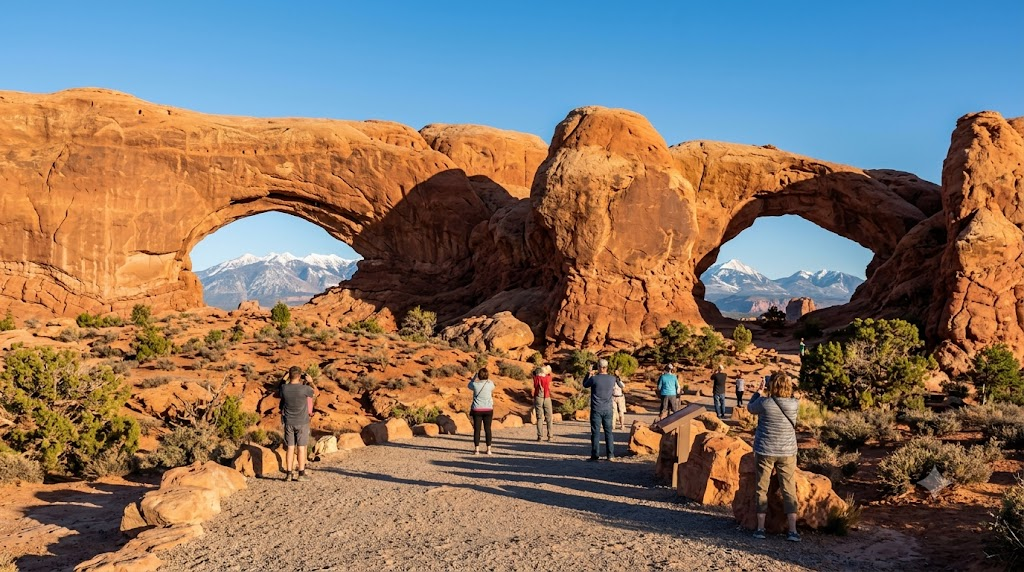
The Windows parking area gives access to three arches in roughly a mile of walking: North Window, South Window, and Turret Arch. The trail starts on gravel with a mild climb, transitions to stone stairs, and puts you close enough to each arch to stand underneath them. The first 100 yards from the parking lot is flat and considered barrier-free, which makes it one of the few sections in the park usable by wheelchair users, even though the full loop is not. Past the arches, an unpaved primitive trail loops around the back side of the Windows for hikers who want a longer walk, but the direct out-and-back to all three arches is what most visitors do, and it’s genuinely one of the most scenic short walks in the park — three arches, framed views of the La Sal Mountains, and none of it requiring more than about 30–45 minutes.
Quick Facts
- Distance: About 1 mile round trip for all three arches
- Estimated Time: 30–45 minutes
- Difficulty: Easy
- Elevation Gain: Modest — a gravel climb followed by stone stairs
- Best For: Visitors who want the most arches per minute of walking
- Wheelchair/Stroller Friendly: Only the first 100 yards
- Insider Tip: Parking fills first here on busy days — if the lot looks full, loop back after visiting Double Arch across the road instead of circling for a spot
Double Arch – Best Easy Hike for Families
Double Arch sits directly across the parking lot from the Windows trailhead, so most people do both in the same stop. The trail itself is short, flat, and sandy, leading to two massive arches that share one base — the tallest arch in the park by height. Kids tend to like this one specifically because the rock at the base invites easy scrambling without any real exposure or danger, though sandstone can be slippery when wet, so caution still applies after rain. Bikes and dogs aren’t permitted on this trail.
Quick Facts
- Distance: About 0.5 miles round trip
- Estimated Time: 20–30 minutes
- Difficulty: Easy
- Elevation Gain: Negligible
- Best For: Families with kids who want to climb and explore safely
- Wheelchair/Stroller Friendly: No — the path is sandy
- Insider Tip: The shaded area under the arch is one of the coolest spots in the park at midday, making this a smart stop to save for the hottest part of your visit
Balanced Rock Loop – Easiest Fully Paved Trail in the Park
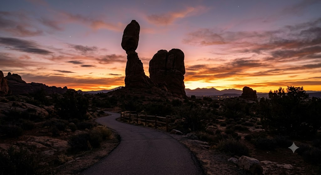
At 0.3 miles and largely paved, this loop circles a boulder the size of three school buses balanced on a narrower sandstone pedestal. It’s one of the most accessible trails in the park — flat enough for most wheelchairs and strollers, with only a few rocky sections and steps along the way — and it’s visible from the road even if you don’t get out of the car. Because it requires almost no time commitment, it’s a natural stop to fold into any Arches itinerary regardless of how much hiking you’re planning to do elsewhere.
Quick Facts
- Distance: 0.3 miles (loop)
- Estimated Time: 10–15 minutes
- Difficulty: Easy
- Elevation Gain: Negligible, with a few short rocky sections
- Best For: Seniors, wheelchair users, or anyone who wants a scenic stop with almost no walking
- Wheelchair/Stroller Friendly: Yes, for most of the loop
- Insider Tip: This spot is worth a second visit at sunset — the rock takes on a deep red tone, and there’s a picnic area nearby if you want to wait it out
Want to know about the size about arches? then check this How Big Is Arches National Park? Size & Facts Guide
Delicate Arch Viewpoints – See the Icon Without the Strenuous Hike
If you want to see Delicate Arch without the 3-mile strenuous hike, there are two shorter options at the same trailhead. The lower viewpoint is a very short, fully paved walk that gives you a distant view of the arch from behind — not the classic postcard angle, but close to level ground and wheelchair accessible. The upper viewpoint is a bit farther and gains some elevation, giving a more familiar angle, though still from a distance rather than up close. Neither substitutes for standing directly beneath the arch, but both are reasonable options for visitors who can’t or don’t want to attempt the full trail, and they take a fraction of the time.
Quick Facts
- Distance: Under 0.2 miles round trip (lower); about 0.5 miles round trip (upper)
- Estimated Time: 10 minutes (lower); 20–25 minutes (upper)
- Difficulty: Easy
- Elevation Gain: None (lower); gradual incline (upper)
- Best For: Visitors who want to see Delicate Arch but can’t manage the full moderate-to-strenuous trail
- Wheelchair/Stroller Friendly: Lower viewpoint yes; upper viewpoint no
- Insider Tip: The upper viewpoint gets far less foot traffic than the main trail at sunset, since most photographers hike all the way to the arch instead — a good option if you want a quieter view of the same golden light
Sand Dune Arch – Best Easy Hike for Young Kids
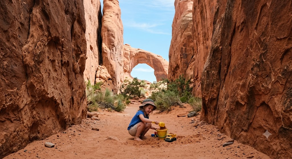
This is consistently recommended as one of the best short hikes for families with young children, and it’s easy to see why: a short, shaded walk through narrow rock fins opens into a small arch surrounded by soft, deep sand that kids can dig in and climb on for as long as patience allows. At 0.3 miles round trip it’s one of the shortest trails in the park, though the loose sand underfoot makes it unsuitable for wheelchairs or strollers. It’s not accessible in the technical sense, but it’s genuinely low-effort for anyone who can walk on sand.
Quick Facts
- Distance: 0.3 miles round trip
- Estimated Time: 15–20 minutes (longer if kids want to play in the sand)
- Difficulty: Easy
- Elevation Gain: None
- Best For: Toddlers and young kids who need somewhere to burn energy
- Wheelchair/Stroller Friendly: No — deep sand throughout
- Insider Tip: This trail is one of the shadiest in the park thanks to the narrow fins on either side, so it’s a good midday option when other trails are baking in full sun
Broken Arch – Least Crowded Easy Hike in the Park
Starting from the same trailhead as Sand Dune Arch, Broken Arch is a longer but still easy walk across an open, sandy meadow to an arch that — despite the name — isn’t actually broken; the “break” is a crack running through the span rather than a missing section. It’s one of the less crowded stops on this list simply because it sits slightly off the main pull-offs along the scenic drive, and the walk itself passes through desert grassland rather than dense rock formations, which gives it a different character from most of the other short hikes here. It can be extended into a loop connecting to Tapestry Arch and the Devils Garden Campground for hikers who want more distance.
Quick Facts
- Distance: Roughly 1.2 miles round trip
- Estimated Time: 30–40 minutes
- Difficulty: Easy
- Elevation Gain: Minimal
- Best For: Visitors who want an easy trail without crowds
- Wheelchair/Stroller Friendly: No
- Insider Tip: There’s no shade across the open meadow section, so this is a better choice for early morning or late afternoon than for a midday walk
Skyline Arch – Shortest Roadside Stop Worth Getting Out of the Car For
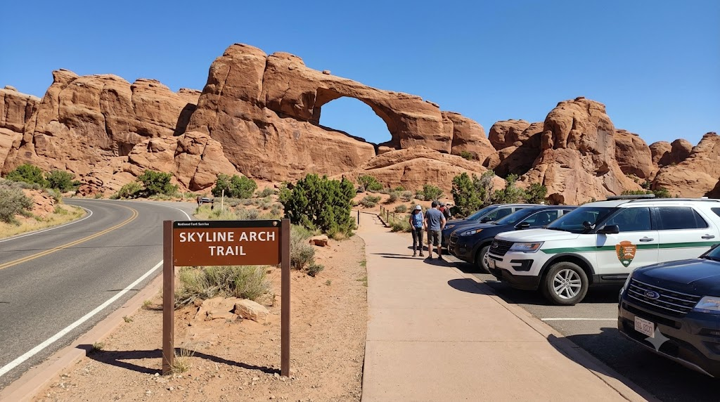
A short, direct trail from a roadside pull-off leads to the base of Skyline Arch, whose opening more than doubled in size after a large rockfall in 1940. At under half a mile round trip on a well-defined path, this is one of the quickest stops in the park — worth building into a driving tour even if you’re not planning to do much walking that day.
Quick Facts
- Distance: 0.4 miles round trip
- Estimated Time: 10–15 minutes
- Difficulty: Easy
- Elevation Gain: Negligible
- Best For: Drivers who want a quick stop without leaving the scenic drive for long
- Wheelchair/Stroller Friendly: No
- Insider Tip: This trail sits right next to the Devils Garden trailhead area, so pair it with Landscape Arch below to avoid backtracking
Landscape Arch – The Longest Easy Walk in Arches
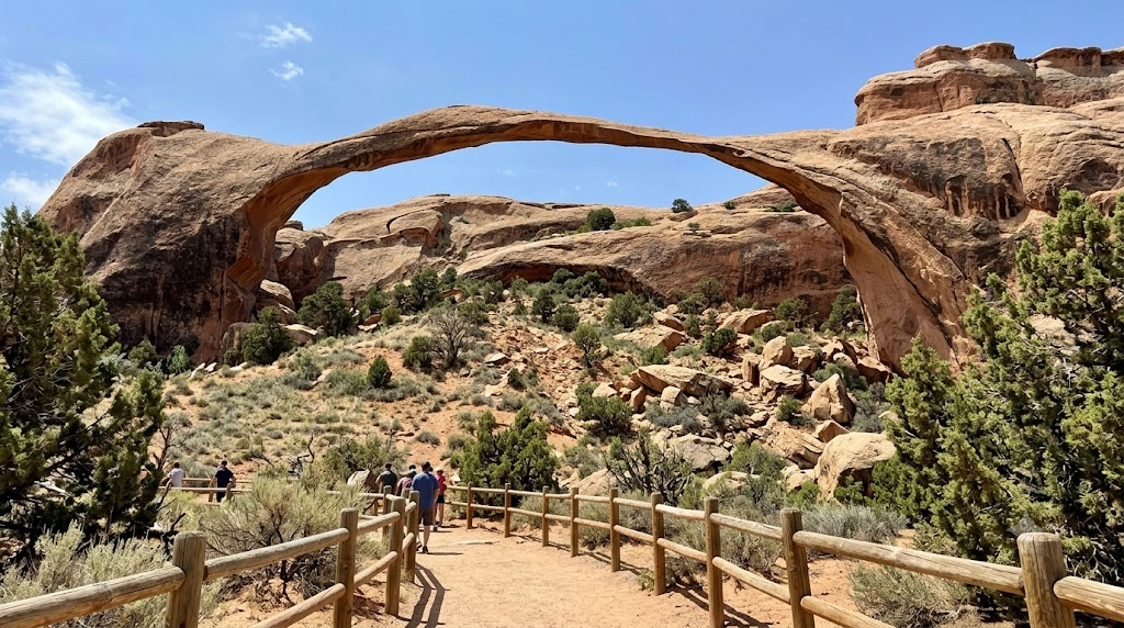
Reaching Landscape Arch — one of the longest natural rock spans on Earth — starts at the Devils Garden trailhead on a flat, hard-packed trail. You won’t be able to walk underneath it; large rockfall debris at its base is a visible reminder that the arch is not considered structurally stable, and the park keeps hikers on a viewing trail well back from it. Along the way, short spur trails branch off to Tunnel Arch and Pine Tree Arch, both worth the small detour if you have time, since they add relatively little distance for two more arches. Past Landscape Arch, the trail continues into the Devils Garden Primitive Loop, which becomes considerably more difficult with scrambling and narrow ledges — that section is not part of this easy-hikes list, and turning back at Landscape Arch is the right call for anyone not specifically prepared for a strenuous route.
Quick Facts
- Distance: Roughly 1.6–2 miles round trip
- Estimated Time: 45–60 minutes, longer with the arch detours
- Difficulty: Easy
- Elevation Gain: Minimal — flat, hard-packed trail
- Best For: Visitors who want the longest easy walk in the park without stepping into strenuous terrain
- Wheelchair/Stroller Friendly: No
- Insider Tip: Watch for the point where the primitive loop splits off past the viewing area — it’s easy to keep walking without realizing the trail difficulty has changed
Which Easy Hike Is Best for You?
| Category | Trail |
|---|---|
| Best Overall | The Windows Section |
| Best for Families | Sand Dune Arch |
| Best for Seniors | Balanced Rock Loop |
| Best for Wheelchairs | Balanced Rock Loop or Park Avenue Viewpoint |
| Best Sunrise Trail | The Windows Section |
| Best Sunset Trail | Balanced Rock Loop |
| Least Crowded | Broken Arch |
| Shortest Walk | Sand Dune Arch (tied with Balanced Rock Loop at 0.3 miles) |
What to Bring, Regardless of How Short the Trail Is
Even the shortest hikes on this list sit in a high-desert environment with little to no shade, and heat exhaustion and dehydration are the most common reasons rangers respond to search-and-rescue calls in the park. Carry more water than feels necessary — the National Park Service does not recommend a specific volume for casual half-mile walks, but the standard park guidance for any hike is to bring more water than you think you’ll use, especially between May and September. Cell service is unreliable through most of the park, so don’t count on a phone to call for help if something goes wrong, and let someone outside your group know your general plan if you’re hiking solo.
Footwear matters more than trail length suggests: several of these trails cross slickrock or loose sand, and closed-toe shoes with real tread outperform sandals even on a 0.3-mile walk. In winter, some trails ice over, and traction devices are worth carrying if you’re visiting between December and February.
Timing Your Visit
Midday sun and midday crowds hit at the same time, roughly 10 a.m. to 3 p.m. during peak season (April through October), so the same early-or-late strategy solves both problems. Sunrise and sunset also happen to be when the sandstone’s color is most dramatic, which is part of why photographers gravitate toward those windows anyway. Arches is also an International Dark Sky Park, and the Windows and Balanced Rock areas stay open after dark for stargazing, which is worth factoring in if your trip allows for a late return.
Frequently Asked Questions
Is the hike to Delicate Arch one of the easy trails on this list?
No. The trail to the base of Delicate Arch is a 3-mile round trip with real elevation gain on exposed slickrock, and the Park Service rates it moderate to strenuous. The lower and upper viewpoint trails covered above are the easy alternatives if you still want to see the arch.
Can I realistically do all ten of these hikes in one day?
Yes, if you start early. Combined, the ten trails add up to roughly 8 miles of walking, and most visitors pair nearby trails (Windows with Double Arch, Sand Dune Arch with Broken Arch) rather than treating them as separate stops. Starting before 8 a.m. and building in breaks for water and shade makes it a comfortable full day rather than a rush.
Are dogs allowed on any of these trails?
Generally, no. Arches restricts pets to roadways, parking areas, and the campground rather than hiking trails, so plan to leave dogs at a pet-friendly kennel in Moab or in an air-conditioned vehicle for short stops only — never in a hot car. Check the park’s current pet policy page before your trip, since specifics can change.
Is Fiery Furnace included in this list of easy hikes?
No. Fiery Furnace requires either a ranger-led tour or a self-guided permit, involves scrambling and squeezing through narrow spaces, and isn’t rated as an easy trail. It’s a separate experience from the walk-up trails covered here.
Which trail should I prioritize if I only have two hours in the park?
The Windows Section and Double Arch, done together from the same parking area, give you four arches in under 90 minutes and are the best value for a short visit.
Do I need hiking boots, or are regular sneakers fine?
Sneakers with decent tread work for every trail on this list. Sandals are the main thing to avoid — sections of slickrock and sand get slippery or uncomfortable in open-toed shoes, even on short walks.
Are restrooms available near these trailheads?
They vary. The Windows/Double Arch parking area and the Devils Garden trailhead have restrooms, along with the visitor center near the entrance. Smaller pull-offs like Skyline Arch and Broken Arch typically don’t, so it’s worth using a larger stop beforehand.
Which trail is best for photographing Delicate Arch at sunrise without the full hike?
The upper viewpoint gives the more recognizable angle and sees noticeably less foot traffic at sunrise than the main trail, since most photographers commit to the full 3-mile hike instead.
Is Landscape Arch stroller-friendly since the trail is flat?
Not reliably. While the surface is flat and hard-packed, sections can get sandy or uneven enough to make stroller pushing difficult, and it’s not officially listed as accessible.
Do these trails get closed if the park reaches capacity?
Individual trailhead parking areas — especially the Windows and Devils Garden — can be temporarily closed by rangers when full, separate from any park-wide entry rules. Arriving early is the most reliable way to avoid this.
Planning the Rest of Your Visit
Ten easy trails is more than enough to fill a full day at Arches, but it’s worth deciding upfront whether you’re optimizing for arch count, photography, or keeping kids happy, since that changes which stops to prioritize if time runs short. If you’re building a broader Moab trip, pair this with [Internal Link: One Day Arches Itinerary] to sequence these trails against drive times and parking patterns, and check [Internal Link: Best Time to Visit Arches National Park] before locking in your dates — season affects both crowd levels and how much water you’ll actually need to carry. Whatever you skip, keep the Delicate Arch distinction in mind: decide in advance whether you’re doing the viewpoint or the full hike, because they’re different trips with different gear needs, not two versions of the same walk.