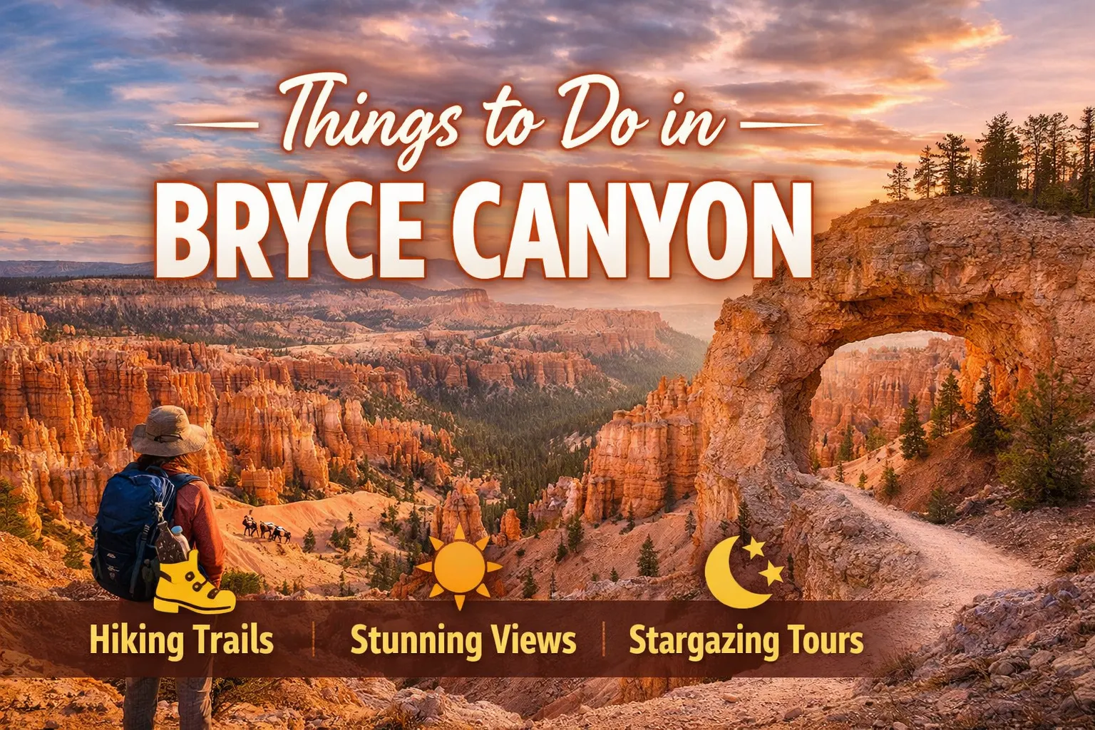
Things to Do in Bryce Canyon National Park: Complete Visitor Guide (2026)
The first time you stand at Sunset Point and look down into Bryce Amphitheater, the scale of it genuinely stops you mid-sentence. You’ve seen the photos. You think you’re prepared. You’re not. The hoodoos — those thousands of orange and ivory spires packed into the canyon like a petrified city — have a way of making every plan you made before arriving feel suddenly inadequate.
Bryce Canyon is one of the most underestimated parks in the American Southwest, and visiting it right takes a bit more thought than showing up and snapping a few rim photos. Here’s everything you actually need to know.
Quick Facts: Bryce Canyon National Park
| Detail | Info |
|---|---|
| Location | Garfield County, southern Utah |
| Nearest Town | Tropic, UT (11 miles); Panguitch, UT (25 miles) |
| Nearest Major City | Las Vegas, NV (~3 hrs); Salt Lake City, UT (~4 hrs) |
| Park Entry Fee | $35 per vehicle (7-day pass), $20 per motorcycle, $15 walk-in/bike |
| Annual Pass | $80 (Bryce-specific); America the Beautiful Pass: $80 (covers all federal lands) |
| Elevation | 8,000–9,115 ft |
| Cell Service | Extremely limited — download offline maps before you arrive |
| Best Months | May–June and September–October |
| Dark Sky Status | International Dark Sky Park since 2014 |
| Shuttle Operates | Mid-April through mid-October (free, runs frequently) |
The Lay of the Land (And Why Elevation Changes Everything)
Bryce Canyon isn’t technically a canyon. It’s a series of natural amphitheaters carved into the eastern edge of the Paunsaugunt Plateau, and sitting at over 8,000 feet of elevation, it doesn’t behave like any desert park you’ve visited before. Summer afternoons bring afternoon thunderstorms that arrive fast and carry real lightning risk if you’re exposed on the rim. Winters pile on genuine snow — sometimes several feet — turning the trails into something genuinely spectacular and occasionally treacherous.

What nobody tells first-time visitors is how badly the altitude hits you, especially if you’re coming straight from Las Vegas. You’ll start the Navajo Loop feeling fine and by the time you hit the Wall Street section, your lungs will be working noticeably harder than usual. Take the first hour slow. It’s not weakness — it’s physiology. The air genuinely has less oxygen up here than you’re used to.
The park road runs roughly 18 miles from the entrance to Rainbow Point at 9,115 feet. Most visitors cluster around Bryce Amphitheater at the northern end, which is where the iconic viewpoints — Sunrise Point, Sunset Point, Inspiration Point, and Bryce Point — are all located. If you only have one day, that’s your focus area. If you have more time, the southern end of the park is dramatically less crowded and worth the drive.
The Best Trails (Ranked by What You’ll Actually Remember)
Navajo Loop + Queen’s Garden Combination
This is the trail at Bryce Canyon. At roughly 2.9 miles when you combine them, it takes you off the rim and deep into the hoodoo landscape in a way that no overlook photo can replicate. You drop 521 feet into Wall Street — a narrow slot between 100-foot sandstone fins where sunlight barely touches the trail floor — emerge at Thor’s Hammer, then wind back up through a landscape that looks genuinely alien.

Start from Sunset Point going down the Navajo Loop, complete the circuit through Queen’s Garden, and exit at Sunrise Point. Then walk the flat Rim Trail back to your car. This direction saves the steep Wall Street descent for when your legs are fresh. Most people do it backwards and spend the last quarter-mile gasping up switchbacks they should have descended.
One real challenge: the Wall Street section is one-way during peak season (descent only). Rangers enforce this. Plan accordingly and check current conditions at the visitor center before you start.
Fairyland Loop
Eight miles, 1,522 feet of elevation gain, and almost always uncrowded. The Fairyland Loop trailhead sits just north of the main Bryce Amphitheater area, and most visitors drive straight past it without stopping. That’s your gain. The trail winds through Tower Bridge — a natural bridge formation that rivals anything in Arches — and offers views of the Aquarius Plateau that you simply don’t get from the main overlooks.

Plan for four to five hours. Bring more food than you think you need, because the trail is genuinely isolated and the terrain works your legs hard. This one earns its mileage.
Rim Trail (Sunrise Point to Bryce Point)
At 5.5 miles one-way, the Rim Trail connects all four major viewpoints along the amphitheater edge. The section between Sunrise and Sunset Point is paved and wheelchair accessible. Beyond that, it becomes a dirt path with some exposure. Catch the sunrise at Sunrise Point — the name is literal and not ironic — then walk south as the light changes the colors of the hoodoos from pink to deep amber. The difference between 6:30 AM and 9 AM light is substantial, and the Rim Trail lets you chase it.

Bryce Canyon in Every Season
Most travel content focuses on summer, which is honestly not the best time to visit. Here’s a more honest breakdown:
Spring (April–June): Snow often lingers through April, sometimes into May at elevation. The shoulder timing between late May and mid-June hits a sweet spot — wildflowers appear on the plateau, temperatures stay manageable, and the summer crowds haven’t fully arrived. Trails dry out enough for solid hiking by mid-May most years.
Summer (July–August): The park is busiest. The shuttle is running and genuinely necessary — the main parking areas fill completely by 9 AM on peak days. Afternoon thunderstorms are a daily reality from late July through August. The Peekaboo Loop trail becomes a shared space with horse tours, which churn the dirt into deep dust. Not ideal for anyone with respiratory sensitivities.
Fall (September–October): This is arguably the best window. Crowds thin dramatically after Labor Day. Temperatures drop to genuinely pleasant hiking weather. The ponderosa pine forest around the plateau edge turns golden, and the low autumn light does extraordinary things to the hoodoo colors. September is the month the park’s rangers seem to quietly love most.
Winter (November–March): Underrated. The park stays open year-round. Snow on the hoodoos creates a visual combination that summer visitors never see. Snowshoe rentals are available. The park loans out microspikes for free when trails are icy — ask at the visitor center. Expect road closures beyond Bryce Point during heavy snow events.
What Most Visitors Skip (And Shouldn’t)
Stargazing at Bryce
Bryce Canyon holds International Dark Sky Park status, and that designation is earned. On a clear night away from the rim-top light pollution of the lodge area, the Milky Way is visible to the naked eye. The park offers ranger-led astronomy programs during summer at the Bryce Amphitheater overlook — check the current program schedule at the visitor center. The best independent viewing spots are near Paria View or the southern pullouts where car headlights don’t sweep across the sky.
Mossy Cave Trail
This one sits outside the main park boundary, off Highway 12 about eight miles east of the visitor center. A 0.8-mile out-and-back leads to a small waterfall and a grotto where water seeps from the canyon walls and supports hanging moss. It’s genuinely different from anything else in the park — cool, damp, almost forested — and most people have never heard of it. Kids love it. Photographers love the late afternoon light inside the cave.

Insider Knowledge: The Shuttle and Parking Reality
During peak season (roughly Memorial Day through Labor Day), the park’s parking situation is a legitimate problem. The Bryce Canyon Visitor Center lot fills before 8 AM. The overflow lot at Ruby’s Inn, just outside the north entrance, connects to the free park shuttle — and this is how you should arrive if you’re visiting July or August. The shuttle runs every 10–15 minutes and stops at all major viewpoints and trailheads.
What the park website doesn’t emphasize clearly enough: if you park at the Bryce Canyon City area and take the shuttle in, you can skip the entrance fee line entirely. Purchase your pass online before you go or use your America the Beautiful Pass at the automated kiosks. The human-staffed booth lines on summer mornings are genuinely slow.
One more thing worth knowing about the shuttle: it doesn’t run to Fairyland Loop trailhead, Mossy Cave, or Rainbow Point. For those, you need your own vehicle regardless of season.
Getting There and Where to Stay
Bryce Canyon sits in the southern Utah canyon country cluster that includes Zion (90 miles southwest), Capitol Reef (120 miles northeast), and Grand Staircase-Escalante National Monument to the east. Highway 12 is one of the most scenic routes in the country — the stretch between Escalante and Torrey is legitimately stunning — and it connects Bryce to Capitol Reef if you’re doing a multi-park trip.
Lodging inside the park is limited to The Lodge at Bryce Canyon, which is historic, charming, and books up months in advance for summer. Tropic, Utah has a handful of smaller motels and cabin rentals at a lower price point. Panguitch has basic chain and independent options. Kanab, about an hour west, is a hub town for this part of Utah with significantly more choices.
Camping at North Campground (near the visitor center) and Sunset Campground is first-come, first-served in portions but mostly reservable through Recreation.gov. Sites at Sunset Campground put you within easy walking distance of Sunset Point, which is worth the slight premium of reserving early.
A Few Things Bryce Canyon Will Genuinely Surprise You With
The cold. Even in late June, temperatures at 8,000 feet drop into the 40s at night, and early morning on the rim can feel genuinely cold regardless of what the daytime high promises. Layers matter specifically here because you’re often descending 500 feet into the canyon where temperatures shift again, then climbing back into direct sun exposure on the rim. Dress for three environments, not one.
The silence in the canyon. Once you’re two switchbacks below the rim on the Navajo Loop, the road noise disappears completely. What you’re left with is wind through the fins, the occasional canyon wren, and the sound of your own footsteps on the sandy trail. It’s one of the rare places in the American West where you can genuinely feel removed from everything — even in the middle of summer with hundreds of other hikers nearby.
Go down into the canyon at least once. Whatever it takes to make that happen — shorter trail, slower pace, borrowed hiking poles from the general store near the lodge — do it. The view from the rim is beautiful. The view looking up at the rim from the canyon floor, surrounded by hoodoos on every side, is something else entirely.
Bryce Canyon rewards people who slow down. Not because it’s hidden or difficult to find — it’s one of the most visited parks in the country — but because its layers reveal themselves gradually. The first pass, you see the shapes. The second, you notice the colors changing by the hour. By the time you’re driving out on Highway 12 watching the plateau shrink in your rearview mirror, you’ll already be doing the math on when you can come back.
Read Also: Where to Stay Near Acadia National Park for First-Time Visitors (2026 Local Guide)