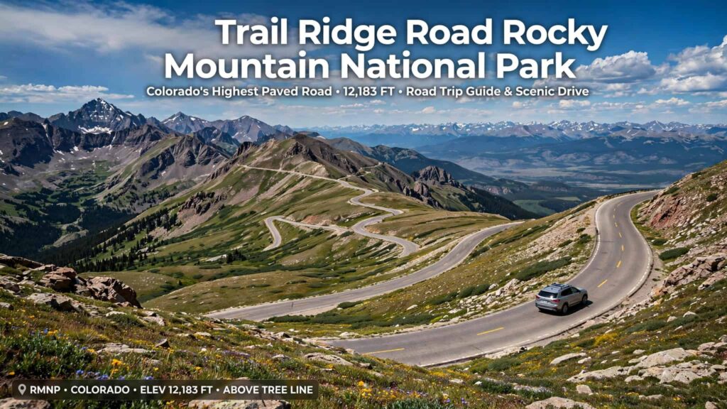
Trail Ridge Road Rocky Mountain National Park: Complete Guide
Trail Ridge Road is one of the most spectacular scenic drives in Colorado and one of the best ways to experience the high country of Rocky Mountain National Park. The road climbs from the forests around Estes Park into the alpine tundra, reaching 12,183 feet (3,713 meters) at its highest point.
The 48-mile route connects Estes Park on the east side of Rocky Mountain National Park with Grand Lake on the west side. Along the way, visitors can see dramatic mountain peaks, alpine meadows, wildlife, snowfields, and some of the highest landscapes accessible by paved road in the United States.
Because Trail Ridge Road reaches extreme elevations and is closed seasonally, planning your visit is important. This guide covers everything you need to know before driving Trail Ridge Road.
What Is Trail Ridge Road?
Trail Ridge Road, also known as U.S. Highway 34 through Rocky Mountain National Park, is the park’s famous high-elevation scenic highway.
The road stretches approximately 48 miles across Rocky Mountain National Park and climbs to 12,183 feet. About 11 miles of the route are above treeline, where forests give way to exposed alpine tundra.
The landscape changes dramatically as you drive:
- Montane forests
- Aspen and pine
- Spruce and fir forests
- Subalpine landscapes
- Alpine tundra
- High mountain passes
- Continental Divide scenery
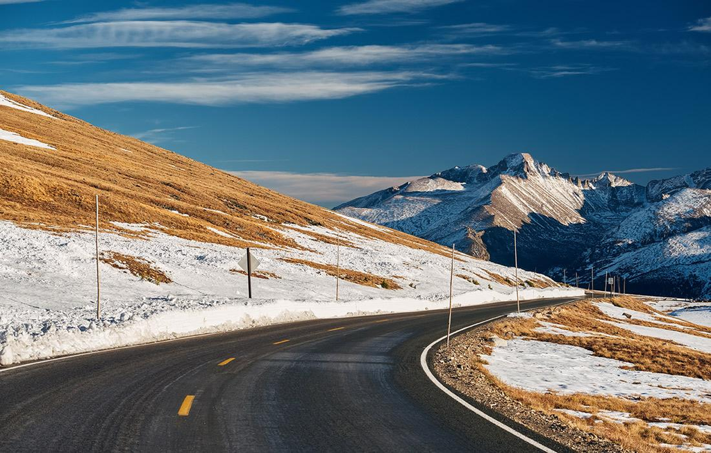
At the highest elevations, temperatures can be dramatically colder than in Estes Park or Grand Lake, and strong winds and rapidly changing weather are common.
Trail Ridge Road Quick Facts
| Feature | Details |
|---|---|
| Location | Rocky Mountain National Park, Colorado |
| Highway | U.S. Highway 34 |
| Length across park | About 48 miles |
| Highest elevation | 12,183 feet |
| Connects | Estes Park and Grand Lake |
| Above treeline | About 11 miles |
| Road type | Paved, seasonal |
| Continental Divide | Crossed at Milner Pass |
| Typical season | Late May through mid-October |
| Best for | Scenic driving, photography, wildlife viewing and short hikes |
Trail Ridge Road is officially described by the National Park Service as the highest continuous paved road in the United States.
Where Does Trail Ridge Road Start and End?
Trail Ridge Road connects Estes Park and Grand Lake through Rocky Mountain National Park.
If you start from the east, the route enters the high country after passing through areas near Beaver Meadows and climbing toward the alpine zone.
From the west, the road travels through the Kawuneeche Valley before climbing toward Milner Pass and the higher elevations.
You can drive the route in either direction, but if you have limited time, plan to spend at least half a day exploring the road and its overlooks. The National Park Service recommends allowing at least half a day for the drive.
Best Stops Along Trail Ridge Road
One of the biggest mistakes visitors make is treating Trail Ridge Road as a drive-through route. There are numerous scenic pullouts and places worth stopping.
1. Many Parks Curve
Many Parks Curve is one of the scenic areas on the eastern side of Trail Ridge Road.
From here, you can look across mountain valleys and see the dramatic elevation changes as the road climbs toward the Continental Divide.
It is a good early stop when driving from Estes Park.
2. Rainbow Curve
Rainbow Curve offers expansive views of the surrounding mountains and valleys.
The landscape here provides a good introduction to the dramatic scenery that becomes even more impressive as you continue toward treeline.
3. Forest Canyon Overlook
Forest Canyon Overlook is another excellent place to stop for panoramic mountain views.
From the overlook, visitors can see deep into Forest Canyon and across the surrounding high peaks.
Bring a jacket even during summer because temperatures can be much colder than in Estes Park.
4. Rock Cut

Rock Cut is one of the highest stops along Trail Ridge Road, sitting at approximately 12,110 feet.
The area is surrounded by alpine tundra and offers an opportunity to experience the extreme environment above treeline. The National Park Service notes that weather at Rock Cut can be severe and that the area contains fragile alpine vegetation.
The Tundra Communities Trail begins near Rock Cut and provides a short opportunity to explore the alpine landscape.
The National Park Service lists the route from Rock Cut to Roger Toll Memorial at approximately 0.5 mile one way, with about 200 feet of elevation gain.
Stay on designated trails because alpine plants grow slowly and are extremely vulnerable to trampling.
5. Alpine Visitor Center

The Alpine Visitor Center is one of the most popular destinations along Trail Ridge Road.
Located at approximately 11,796 feet, it is the highest visitor center in the National Park Service. The area normally operates seasonally and can remain chilly even during summer.
The visitor center area provides:
- Mountain views
- Restrooms
- Visitor information
- Access to alpine trails
- Seasonal food and shopping nearby
The Alpine Ridge Trail is one of the popular short hikes in this area.
Keep in mind that facilities can open later or close earlier depending on snow and weather conditions.
6. Fall River Pass
Fall River Pass is located in the high country near the Alpine Visitor Center and is an important point along the road.
The surrounding landscape provides some of the most impressive views of the alpine environment.
7. Milner Pass
Milner Pass is one of the most interesting stops because it sits directly on the Continental Divide.
At approximately 10,758 feet, it is lower than Trail Ridge Road’s highest point but marks the divide between waters flowing toward the Atlantic and Pacific drainage systems.
8. Lake Irene
Lake Irene is located on the western side of the Continental Divide and provides a quieter scenic stop compared with some of the more popular overlooks.
If you’re driving toward Grand Lake, it is a worthwhile place to slow down and enjoy the surrounding alpine landscape.
How High Is Trail Ridge Road?
Trail Ridge Road reaches an elevation of 12,183 feet (3,713 meters).
That elevation is one of the main reasons the road is so spectacular—and also why visitors need to take altitude and weather seriously.
At high elevations, you may notice:
- Shortness of breath
- Headache
- Dizziness
- Fatigue
- Nausea
Altitude sickness can affect visitors even if they are physically fit. The National Park Service recommends taking your time, drinking water, resting, and descending to a lower elevation if symptoms become serious.
When Does Trail Ridge Road Open?
Trail Ridge Road is a seasonal road.
It generally opens in late May, although the exact opening date varies depending on snowfall, snow removal and weather conditions.
Historically, the road has opened on dates ranging from early May to late June. The National Park Service notes that plowing operations are affected by snow, wind, ice and storms at high elevations.
For example, the road officially opened for the 2026 season on May 29, 2026, but visitors were warned about melting snow, icy conditions and rapidly changing weather.
Important: Never assume Trail Ridge Road is open simply because it is late spring or summer. Always check the current road status before your trip.
Check current Trail Ridge Road status – NPS
When Does Trail Ridge Road Close?
Trail Ridge Road normally closes to through traffic around mid-October through Memorial Day weekend, although the exact dates can vary.
The National Park Service lists Trail Ridge Road as seasonally closed from approximately mid-October to Memorial Day weekend. Temporary closures can also happen because of snow, ice, storms, construction or other safety concerns.
Even after the road opens for the season, snow can remain along the roadside and around the highest elevations.
Do You Need a Timed Entry Reservation for Trail Ridge Road?
Yes, during certain hours in 2026.
This is an important detail for anyone planning a Trail Ridge Road scenic drive.
For 2026, Rocky Mountain National Park requires a Timed Entry reservation to enter the park between 9 a.m. and 2 p.m. from May 22 through October 12 for areas outside the Bear Lake Road Corridor.
The regular Timed Entry reservation is the appropriate option for visitors planning to drive Trail Ridge Road or visit the Alpine Visitor Center.
Visitors entering before 9 a.m. or after 2 p.m. generally do not need a timed entry reservation for the areas covered by this option, although a valid park entrance pass or fee is still required.
How the 2026 reservation works
A timed entry reservation:
- Is required during the applicable hours
- Covers one vehicle
- Uses a designated two-hour entry window
- Does not guarantee parking at a particular location
- Costs a $2 Recreation.gov processing fee
- Is separate from the regular park entrance fee/pass
Once you enter the park during your designated window, you can stay as long as you like.
Reserve Rocky Mountain National Park Timed Entry – Recreation.gov
What Is the Best Time to Drive Trail Ridge Road?
For most visitors, July through September offers the best chance of experiencing the entire road after seasonal opening.
June
June can be beautiful, but snow can still be present at high elevations. Some facilities may also have limited seasonal operations.
July and August
These are popular months because the road is generally fully accessible and alpine wildflowers may be blooming.
However, summer afternoons can bring thunderstorms, so an early start is often a smart choice.
September
September can be an excellent time for Trail Ridge Road. Crowds may decrease compared with the peak summer period, while the high country can still be accessible.
Fall weather can change quickly, however.
October
Early October can provide beautiful autumn scenery at lower elevations, but winter weather can return quickly at high elevations. The road normally closes for the season around mid-October.
What Is the Best Time of Day for Trail Ridge Road?
Morning is generally the best time.
Starting early can help you:
- Avoid some traffic
- Get better parking at popular stops
- Have more time for hiking
- Reduce the chance of afternoon thunderstorms
- Enjoy clearer mountain views
If you have a timed entry reservation, remember that you must enter the park during your designated two-hour window.
Trail Ridge Road Weather
Weather is one of the most important things to consider before driving Trail Ridge Road.
Conditions at 12,000 feet can be completely different from conditions in Estes Park or Grand Lake.
The National Park Service warns that alpine weather can change rapidly and that Trail Ridge Road can experience freezing temperatures, snow, ice, strong winds and thunderstorms.
Even in July or August, pack:
- A warm jacket
- Extra layers
- Water
- Sunglasses
- Sunscreen
- Sturdy shoes
- Rain protection
Don’t rely on the weather in town to determine conditions at the top of Trail Ridge Road.
Wildlife You May See on Trail Ridge Road
Trail Ridge Road passes through habitats where wildlife is commonly seen.
Possible sightings include:
- Elk
- Bighorn sheep
- Marmots
- Pikas
- Moose
- Ptarmigans
- Other alpine and mountain wildlife
The National Park Service specifically highlights pikas, marmots, ptarmigans and bighorn sheep as species commonly seen in the alpine areas.
Never approach, feed or attempt to touch wildlife.
If you see animals near the road, slow down and give them plenty of space.
Hiking Near Trail Ridge Road
You don’t have to undertake a long hike to experience the alpine environment.
Some short hiking opportunities are located near the road.
Tundra Communities Trail
This is one of the easiest ways to experience the high alpine landscape.
The trail begins near Rock Cut and leads toward Roger Toll Memorial. The National Park Service lists it at about 0.5 mile one way.
Alpine Ridge Trail
Near the Alpine Visitor Center, the Alpine Ridge Trail climbs through exposed alpine terrain.
Because of the elevation, even short hikes can feel considerably harder than their distance suggests.
Take your time and turn around if weather or altitude becomes uncomfortable.
Is Trail Ridge Road Safe?
Trail Ridge Road is a paved highway, but it is still a high-mountain road.
Drivers should be prepared for:
- Steep grades
- Sharp curves
- Narrow sections
- Wildlife crossing the road
- Sudden weather changes
- Snow and ice
- Strong winds
- Heavy summer traffic
The road’s maximum grade does not exceed approximately 7%, according to the National Park Service.
Safety tips
Check road conditions before leaving.
A road that was open in the morning can experience temporary closures because of weather.
Don’t stop in the middle of the road.
Use designated pullouts.
Drive slowly.
Other visitors may be unfamiliar with mountain driving.
Watch for wildlife.
Animals can appear around curves or near roadside areas.
Stay on designated trails.
Alpine vegetation is extremely fragile.
Prepare for altitude.
Drink water, rest and descend if you experience significant altitude symptoms.
Can You Bike Trail Ridge Road?
Yes. Trail Ridge Road is a popular challenge for experienced cyclists.
However, cycling at elevations approaching 12,000 feet is physically demanding.
The National Park Service requires cyclists to travel in the same direction as vehicle traffic and ride single file. Roads can be narrow, steep and winding, with limited shoulders and significant traffic during summer.
Cyclists should also be prepared for rapidly changing alpine weather.
How Long Does It Take to Drive Trail Ridge Road?
A nonstop drive across the approximately 48-mile route can take considerably less time than a complete sightseeing trip.
For visitors who want to stop at overlooks, take photographs, visit the Alpine Visitor Center and explore short trails, plan at least half a day.
If you want to enjoy the drive without rushing, a full day gives you considerably more flexibility.
Remember that the road is not simply about getting from Estes Park to Grand Lake. The scenic pullouts and high-elevation landscapes are a major part of the experience.
Trail Ridge Road Photography Tips
Trail Ridge Road is one of the best photography locations in Rocky Mountain National Park.
For the best results:
- Start early for softer light.
- Stop at designated viewpoints.
- Photograph the road curves from safe pullouts.
- Use a wide-angle lens for mountain panoramas.
- Look for wildlife without approaching it.
- Capture both the alpine tundra and forest zones.
- Keep an eye on clouds for dramatic mountain scenes.
The landscape changes so dramatically with elevation that the drive itself provides many different photographic environments.
What to Bring on a Trail Ridge Road Drive
A simple packing list can make your trip much more comfortable.
Essentials
- Park entrance pass or payment method
- Timed Entry reservation when required
- Water
- Warm layers
- Rain jacket
- Sunscreen
- Sunglasses
- Comfortable shoes
- Snacks
- Phone/camera
- Car charger or power bank
Cell service can be unreliable in parts of Rocky Mountain National Park, so save important reservation information and maps before entering the park.
Trail Ridge Road Itinerary
If you’re driving from Estes Park to Grand Lake, a simple itinerary could look like this:
Morning:
Enter Rocky Mountain National Park and begin climbing toward the high country.
First stops:
Many Parks Curve and Rainbow Curve.
Midday:
Stop at Forest Canyon Overlook and continue toward Rock Cut.
High country:
Explore Rock Cut and the alpine tundra.
Next stop:
Visit the Alpine Visitor Center.
Continental Divide:
Continue toward Milner Pass.
Afternoon:
Drive through the western side of the park toward Grand Lake, stopping at scenic areas along the way.
This itinerary can easily take most of a day if you stop frequently.
Is Trail Ridge Road Worth Visiting?
Absolutely.
Trail Ridge Road offers something that few scenic drives can match: the ability to travel from mountain forests to an exposed alpine environment above 12,000 feet on a paved road.
The combination of:
- 12,183-foot elevation
- Alpine tundra
- Continental Divide views
- Mountain wildlife
- Scenic overlooks
- Snowfields
- Wildflowers
- Short hikes
- Dramatic weather
makes Trail Ridge Road one of the signature experiences in Rocky Mountain National Park.
Final Tips for Visiting Trail Ridge Road
Before your trip, remember these key points:
- Check the current road status before driving.
- Check whether a timed entry reservation is required for your arrival time.
- Allow at least half a day for the scenic drive.
- Start early when possible.
- Bring warm clothing even in summer.
- Expect colder temperatures at high elevations.
- Never approach or feed wildlife.
- Stay on designated trails and protect alpine vegetation.
- Don’t rely on town weather forecasts for conditions at 12,000 feet.
- Be flexible because weather can cause temporary closures.

Frequently Asked Questions About Trail Ridge Road
How high is Trail Ridge Road?
Trail Ridge Road reaches 12,183 feet (3,713 meters) above sea level, making it the highest continuous paved road in the United States.
How long is Trail Ridge Road?
The route is approximately 48 miles across Rocky Mountain National Park, connecting Estes Park and Grand Lake.
Is Trail Ridge Road open year-round?
No. Trail Ridge Road is a seasonal road and is generally closed to through traffic from around mid-October until Memorial Day weekend. Weather can alter the exact opening and closing dates.
Do I need a reservation for Trail Ridge Road?
During the 2026 timed-entry season, a Timed Entry reservation is required to enter most areas of Rocky Mountain National Park between 9 a.m. and 2 p.m., including for visitors planning to drive Trail Ridge Road.
What is the best month to drive Trail Ridge Road?
July, August and September are generally among the best months for a complete scenic drive, although conditions can vary from year to year.
Can you see snow on Trail Ridge Road in summer?
Yes. Snow can remain at high elevations well into summer, and late-season storms are possible. Conditions vary significantly by year.
Is Trail Ridge Road scary to drive?
It can feel intimidating because of the elevation, curves, steep mountain terrain and changing weather. However, it is a paved road designed for vehicle travel. Drive carefully, stay within posted limits and use designated pullouts.
Official Resources
Trail Ridge Road – National Park Service
Current Road Status – Rocky Mountain National Park
Timed Entry Permit Information – Rocky Mountain National Park
Rocky Mountain National Park Timed Entry – Recreation.gov
Editorial note for publishing: Because Trail Ridge Road opening/closing dates, weather, facilities and timed-entry rules can change, keep the 2026 reservation details updated each season and link readers to the official NPS road-status and timed-entry pages.
Also Read: Rocky Mountain National Park Weather by Month: Temperatures, Snow & Rain
Pingback: Is Rocky Mountain National Park Open? Current Status, Closures & Hours - Park Trails Guide