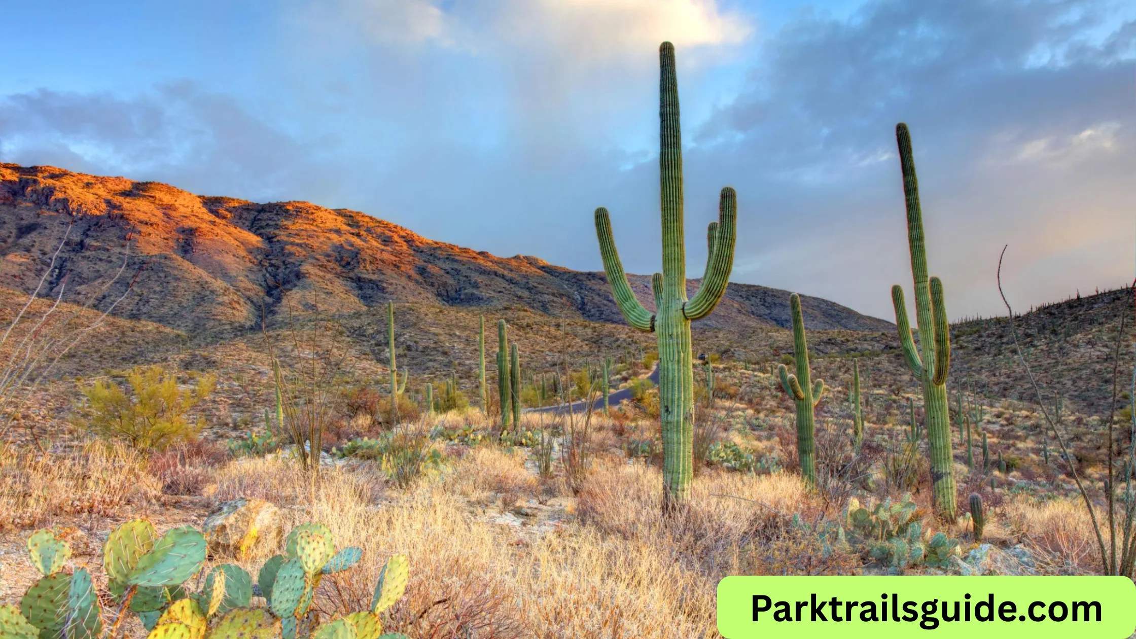
Saguaro National Park is one of the most unique and beautiful desert parks in the United States. Located in Tucson, this park is famous for its giant saguaro cacti, stunning desert landscapes, and scenic drives.
If you are planning a visit in 2026, understanding the park map is very important. The park is divided into two separate districts, and knowing how to navigate them will help you save time and enjoy your trip more.
In this guide, you will learn everything about the Saguaro National Park map, including key locations, scenic routes, hiking trails, and practical travel tips.
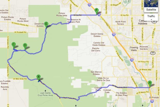
Saguaro National Park Map
One of the most important things to know is that Saguaro National Park is split into two districts:
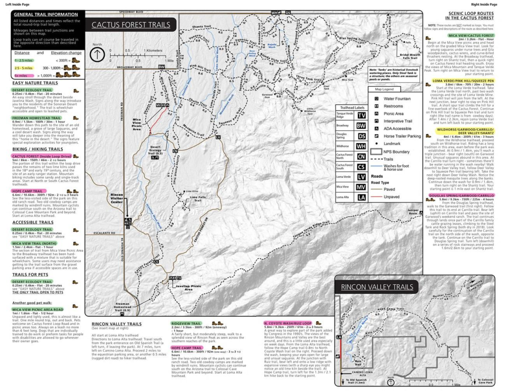
1. Rincon Mountain District (East)
Also called Saguaro East, this area is known for:
- Dense saguaro forests
- Scenic loop drive
- Popular hiking trails
Key highlight: Cactus Forest Drive, an 8-mile scenic loop.
2. Tucson Mountain District (West)
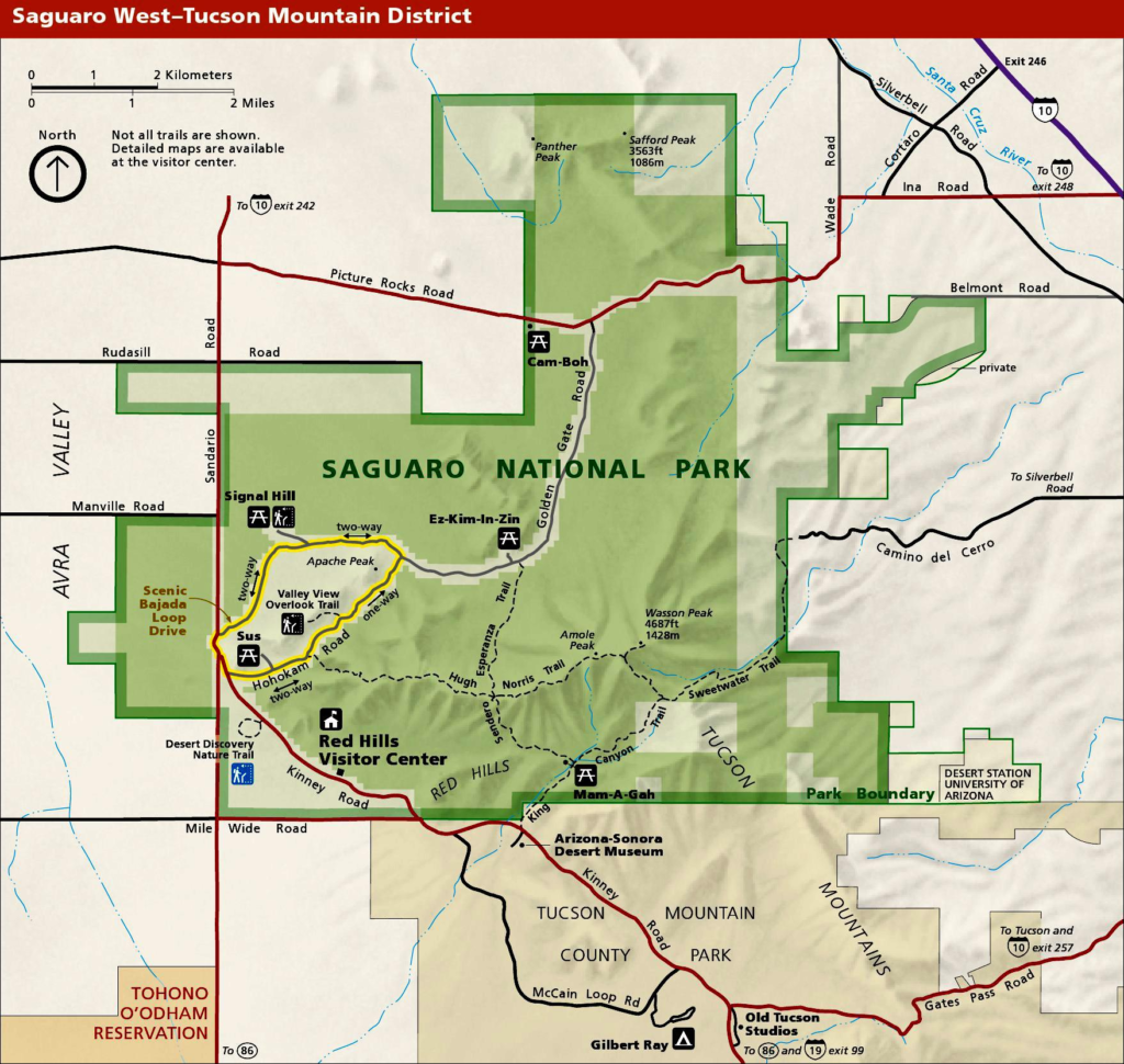
Also known as Saguaro West, this area offers:
- Beautiful sunset views
- Short easy trails
- Cultural sites like petroglyphs
Key highlight: Bajada Loop Drive, a 6-mile scenic drive.
Key Locations on the Map
When you look at the park map, you will notice several important spots marked for visitors.
Visitor Centers
- Rincon Mountain Visitor Center (East)
- Red Hills Visitor Center (West)
These centers provide:
- Free maps
- Restrooms
- Information about trails and safety
Scenic Drives
Both districts have scenic drives that are clearly marked on the map.
Cactus Forest Drive (East):
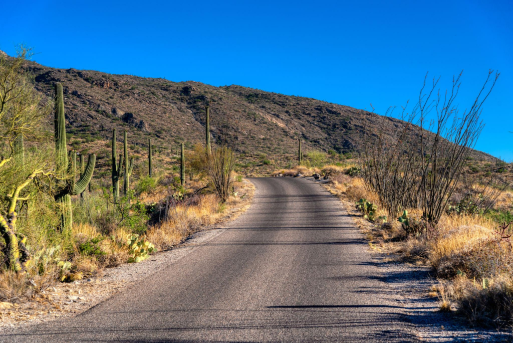
- One-way loop road
- Ideal for photography
- Best for sunrise views
Bajada Loop Drive (West):
- Short but very scenic
- Great for sunset
- Includes access to hiking trails
Popular Trailheads
The park map highlights several trailheads. Some of the most popular include:
- Valley View Overlook Trail
- Signal Hill Trail
- Freeman Homestead Trail
- Douglas Spring Trail
Each trail is marked with distance and difficulty level, making it easier to plan your hike.
How to Use the Saguaro National Park Map
Understanding the map properly can make your visit smooth and enjoyable.
1. Choose Your District First
Since the two districts are about 30 miles apart, you should decide in advance which one to visit.
- Choose East for longer hikes and forest views
- Choose West for shorter visits and sunsets
2. Plan Your Route
Look at the map and:
- Identify entrance points
- Mark scenic drives
- Select trails based on time
3. Check Distances
The map clearly shows distances between key spots. This helps you:
- Save time
- Avoid getting lost
- Plan fuel stops
4. Download Offline Map
Mobile signals may be weak inside the park. It is a good idea to:
- Download Google Maps offline
- Carry a printed park map
Best Scenic Drives on the Map
Driving is one of the easiest ways to explore Saguaro National Park.
Cactus Forest Drive (East)
- Distance: 8 miles
- Type: One-way paved road
- Time needed: 1–2 hours
Highlights:
- Dense cactus forests
- Mountain views
- Picnic areas
Bajada Loop Drive (West)
- Distance: 6 miles
- Type: Gravel road
- Time needed: 1 hour
Highlights:
- Sunset viewpoints
- Petroglyphs
- Easy trail access
Best Hiking Trails on the Map
The park map shows many trails for all fitness levels.
Easy Trails
- Valley View Overlook Trail (West)
- Freeman Homestead Trail (East)
Good for beginners and families.
Moderate Trails
- Signal Hill Trail (West)
- Mica View Trail (East)
These trails offer great views without being too difficult.
Challenging Trails
- Tanque Verde Ridge Trail
- Douglas Spring Trail
Best for experienced hikers.
Map Tips for First-Time Visitors
If you are visiting for the first time, keep these tips in mind:
Start Early
Desert temperatures can get very high. Morning visits are best.
Carry Essentials
Always bring:
- Water
- Sunscreen
- Hat
- Snacks
Follow Marked Trails
The map shows clearly marked trails. Do not go off-track, as desert navigation can be difficult.
Watch for Wildlife
The park is home to:
- Snakes
- Coyotes
- Birds
Always stay alert and respect wildlife.
East vs West: Which Side Should You Visit?
Here is a simple comparison to help you decide:
| Feature | East (Rincon) | West (Tucson) |
|---|---|---|
| Crowd Level | Less crowded | More popular |
| Trails | Longer hikes | Short trails |
| Scenic Drive | Cactus Forest | Bajada Loop |
| Best Time | Morning | Sunset |
If you have only one day, most visitors prefer the West side for its easy access and beautiful views.
Printable and Digital Maps
You can access maps in two ways:
1. Official Park Map
Available at visitor centers or the National Park Service website.
2. Google Maps
Search for Saguaro National Park and navigate easily.
3. Mobile Apps
Useful apps include:
- AllTrails
- Google Maps
- National Park apps
Best Time to Visit Based on the Map
The map helps you plan visits based on weather and location.
Winter (Best Season)
- Pleasant weather
- Ideal for hiking
Spring
- Wildflowers bloom
- Great photography
Summer
- Very hot
- Visit early morning only
Fall
- Fewer crowds
- Comfortable weather
Suggested 1-Day Itinerary Using the Map
Option 1: West District
- Start at Red Hills Visitor Center
- Drive Bajada Loop
- Hike Valley View Trail
- Visit Signal Hill
- Stay for sunset
Option 2: East District
- Start at Rincon Visitor Center
- Drive Cactus Forest Loop
- Hike Freeman Homestead Trail
- Picnic lunch
- Explore scenic viewpoints
Safety Tips While Using the Map
- Always inform someone about your plan
- Stay hydrated
- Avoid hiking during midday heat
- Check weather conditions
Frequently Asked Questions (FAQs)
Is Saguaro National Park easy to navigate?
Yes, the park map is simple and clearly marked, making navigation easy for visitors.
Can I visit both districts in one day?
It is possible, but not recommended due to the 30-mile distance between them.
Are maps available offline?
Yes, you can download maps or get printed copies at visitor centers.
Which district is better for beginners?
The West district is better for beginners due to shorter trails and easy access.
Final Thoughts
The Saguaro National Park map is your best tool for planning a smooth and enjoyable trip. Whether you want scenic drives, hiking trails, or photography spots, the map helps you find everything easily.
By understanding the layout of both districts, choosing the right routes, and following simple travel tips, you can make the most of your visit in 2026.
If you are visiting Tucson, this park is a must-see destination that offers a true desert experience unlike anywhere else.
Read Also: Big Bend National Park Map: Complete Visitor Guide

Rubie Rose is a travel writer with a focused specialty in USA national parks, hiking trails, and practical outdoor trip planning. She is the founder and lead writer of Park Trails Guide — an independent resource built to help everyday visitors explore America’s parks with real confidence, not just enthusiasm.