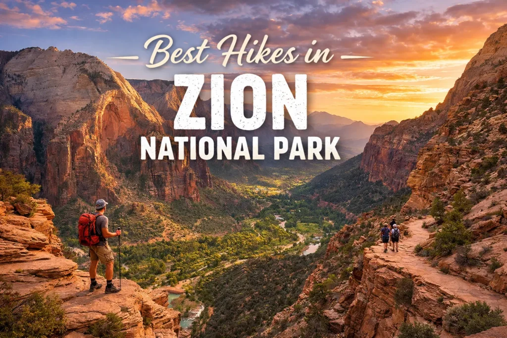
Best Hikes in Zion National Park Ranked by Difficulty (2026 Guide)
Nearly every visitor to Zion National Park had a memorable experience. Huge red rock cliffs, little valleys, and bright blue skies suddenly around you as you go along the streets. The scenery is so beautiful that it sometimes seems strange.
Zion National Park, which is situated in southern Utah, is one of those locations that makes an impression. In addition to being stunning, it regularly surpasses visitors’ expectations in terms of presentation.
However, a lot of new hikers are uninformed of how challenging Zion’s trails may be. While some routes are simple river walks, others have difficult parts and steep hills that call for a lot more work. It’s crucial to select a path that fits your level of fitness, particularly in Utah’s hot summer months. Choosing a trail that is too challenging can rapidly transform a fun trip into a dangerous and stressful one.
The top hikes in Zion National Park are ranked by difficulty in this guide, covering everything from family-friendly hikes to challenging backcountry adventures requiring preparation and experience. This is the trail guideline you really need in 2026, no matter how many times you plan to visit.
What Makes Zion Hikes Unique — and Uniquely Dangerous
Before we dive into the rankings, it’s worth understanding what separates Zion from other national parks. Zion’s terrain is dominated by Navajo Sandstone — a porous, red-orange rock that was formed from ancient desert dunes. It’s stunning. It’s also slippery when wet, crumbly at exposed edges, and radiating heat in summer like an oven set to “broil.”
The National Park Service reports that Zion sees over 5 million visitors annually, and search-and-rescue operations happen with alarming regularity — particularly on the park’s more technical trails. Flash floods in the slot canyons are not rare events; they’re seasonal certainties. Heat exhaustion is a summer staple on canyon-bottom trails where the sun reflects off every wall.
None of this should scare you away. It should make you prepared. Knowing your trail — and your honest fitness level — is the most important gear you’ll ever pack.
Easy Hikes: Perfect for Families, Beginners & Recovery Days
Riverside Walk (Pa’rus Trail)
Distance: 2.2 miles round trip | Elevation Gain: Minimal | Time: 1–1.5 hours
If you want Zion’s iconic canyon scenery without breaking a sweat, the Riverside Walk is your answer. This paved trail follows the Virgin River from the Temple of Sinawava shuttle stop into the Gateway to the Narrows — the point where the canyon walls close in and the real magic begins.

It’s wheelchair-accessible, stroller-friendly, and genuinely beautiful. The river glitters alongside you the whole way. In spring, wildflowers crowd the banks. In fall, the cottonwood trees turn the whole canyon floor gold. Rangers call this one of the most-photographed trails in the park, and it’s easy to see why.
Pro tip: Walk it at golden hour. The late afternoon light bouncing between the canyon walls is absolutely worth adjusting your schedule for.
Pa’rus Trail
Distance: 3.5 miles round trip | Elevation Gain: ~50 feet | Time: 1.5–2 hours
Often overlooked in favor of flashier hikes, the Pa’rus Trail is the park’s only trail open to bikes and leashed pets. It runs along the Virgin River from the South Campground to Canyon Junction, offering unobstructed views of some of Zion’s most recognizable formations — the Watchman, Bridge Mountain, and the Towers of the Virgin.
It’s wide, paved, and relaxed. Think of it as Zion’s front porch — a place to ease in, get your bearings, and start falling in love with the landscape before the real climbing begins.
Moderate Hikes: The Sweet Spot for Most Visitors
Angels Landing — Lower Sections (Scout Lookout)
Distance: 4 miles round trip to Scout Lookout | Elevation Gain: ~1,050 feet | Time: 2.5–3.5 hours
Angels Landing is probably the most famous hike in Zion and one of the most recognizable trails in the American Southwest. The full experience includes a final half-mile scramble along a razor-thin ridge using chains bolted into the rock — but that section is decidedly not moderate.

Here’s what many guides don’t emphasize enough: Scout Lookout, the broad plateau just before the chain section begins, is a spectacular destination in its own right. The views down into Zion Canyon are sweeping and dramatic. The climb through Walter’s Wiggles — a series of 21 steep, short switchbacks carved directly into the cliff — is one of the most satisfying finishes to any moderate hike you’ll find.
Important 2026 update: A permit lottery system has been in place for Angels Landing since 2022, and it remains active. Day-use permits are required for the chain section and are distributed via recreation.gov through seasonal and day-before lotteries. Plan ahead — competition is intense, especially from March through November.
Emerald Pools Trails
Distance: 1.2 to 3 miles (depending on which pools you visit) | Elevation Gain: 69–350 feet | Time: 1–3 hours
The Emerald Pools trail system is actually three connected trails in one, leading to the Lower, Middle, and Upper Emerald Pools. The Lower Pool trail is essentially easy — a shaded, paved path leading to a hanging garden and waterfall. Middle and Upper get progressively more challenging with rocky terrain and steeper climbs.
The payoff is genuinely magical. Alcoves draped with ferns, hanging moss, and the sound of water echoing off sandstone walls. In summer, those pools feel like finding an oasis. In winter, the frozen waterfalls create something that looks almost unreal.
Canyon Overlook Trail
Distance: 1 mile round trip | Elevation Gain: ~163 feet | Time: 45 minutes–1 hour
Short, punchy, and ridiculously rewarding — the Canyon Overlook Trail starts at the east side of the Zion-Mount Carmel Tunnel and delivers one of the best views-per-effort ratios in the entire park. You’re looking down into Pine Creek Canyon and the upper end of Zion Canyon from a sandstone ledge that genuinely makes you feel like you’re standing on the edge of the world.
The trail includes some exposed sections with handrails, sandy patches, and a few uneven rock steps. It’s manageable for most people but does require some care. Not recommended in wet conditions.
Strenuous Hikes: For the Fit and the Fearless
Angels Landing — Full Route (Chain Section)
Distance: 5.4 miles round trip | Elevation Gain: ~1,488 feet | Time: 4–5 hours
Now we’re into the section that gets the heart pounding. The chain section of Angels Landing begins at Scout Lookout and traverses a narrow sandstone fin — sometimes only a few feet wide — with sheer drop-offs on both sides. The chains are permanently bolted into the rock and are genuinely necessary; this is not casual scrambling.
Five fatalities have been recorded on Angels Landing since the park opened, nearly all involving falls from the chain section. The NPS strongly advises avoiding this trail if you have a fear of heights, in wet or icy conditions, or without the required permit.
That said, on a clear day with a valid permit and a head for heights? This is one of the most exhilarating hikes in the United States. The 360-degree views from the summit at 5,790 feet are the kind you carry with you for the rest of your life.
Hidden Canyon Trail
Distance: 2.4 miles round trip | Elevation Gain: ~850 feet | Time: 2–3 hours
Tucked away on the east side of Zion Canyon, Hidden Canyon is one of the park’s best-kept secrets. The trail involves a narrow, exposed traverse with chains — similar in character to Angels Landing but significantly less crowded. At the end, you enter an actual hidden slot canyon, narrow and silent, accessible only if you’re willing to scramble over boulders and wade through sandy stretches.

This trail gets far less attention than Angels Landing, which means you might have the canyon almost to yourself. That alone makes it worth the effort.
Observation Point Trail
Distance: 8 miles round trip | Elevation Gain: ~2,148 feet | Time: 4–6 hours
Serious hikers often argue that Observation Point — not Angels Landing — is Zion’s greatest hike. At 6,507 feet, the summit stands roughly 800 feet above Angels Landing. You look down at Angels Landing from up here, which puts the whole park’s scale into jaw-dropping perspective.
The trail climbs through Echo Canyon, a stunning narrow gorge, before emerging onto the plateau. It’s long and demanding, but the route is never technically dangerous — just relentlessly uphill. Start early, carry 3+ liters of water per person, and pace yourself.
Expert-Level Hikes: Backcountry, Permits & Full Commitment
The Narrows — Top-Down Full Route
Distance: ~16 miles one-way | Elevation Gain: Minimal (mostly downstream) | Time: Overnight, 2 days
The Narrows is Zion’s crown jewel — a river hike through one of the deepest slot canyons in North America, where the Virgin River is the trail. In places, the canyon is barely 20 feet wide, with walls soaring 1,000 feet above you. Walking downstream through knee-deep (sometimes waist-deep) water, with sunlight filtering through the slot in ribbons, is a genuinely life-altering experience.
The full top-down route requires a backcountry permit from recreation.gov, a dry suit or wetsuit depending on season, canyoneering shoes, and a hiking staff. Flash flood risk is significant — permits are cancelled or prohibited on high-risk days by the park service. Never enter The Narrows if there’s rain in the forecast upstream.
The bottom-up day hike (from Riverside Walk) is accessible to most visitors. The full overnight route is for experienced backcountry hikers only.
Subway (Left Fork)
Distance: 9.5 miles round trip (or 8-mile top-down technical route) | Elevation Gain: Varies | Time: 5–8 hours
The Subway is the hike that Zion regulars speak about in reverent tones. Named for the tunnel-shaped rock formations in its lower section, it involves boulder-hopping, log-scaling, swimming through pools, and route-finding through a canyon with no marked trail. The technical top-down route requires rappelling skills and gear.

A permit is required year-round, and the competition for those permits is fierce. Many applicants enter the lottery multiple seasons before securing a spot. If you get one: go. Cancel everything. Go.
Quick Reference: Zion Hikes Ranked by Difficulty
| Trail | Distance | Elevation Gain | Difficulty | Permit Required |
|---|---|---|---|---|
| Riverside Walk | 2.2 mi | ~57 ft | Easy | No |
| Pa’rus Trail | 3.5 mi | ~50 ft | Easy | No |
| Canyon Overlook | 1 mi | ~163 ft | Easy–Moderate | No |
| Emerald Pools (Lower) | 1.2 mi | ~69 ft | Easy | No |
| Emerald Pools (Upper) | 3 mi | ~350 ft | Moderate | No |
| Hidden Canyon | 2.4 mi | ~850 ft | Strenuous | No |
| Angels Landing (to Scout Lookout) | 4 mi | ~1,050 ft | Moderate–Strenuous | No |
| Angels Landing (Full) | 5.4 mi | ~1,488 ft | Strenuous | Yes |
| Observation Point | 8 mi | ~2,148 ft | Strenuous | No |
| The Narrows (Bottom-Up) | Up to 10 mi | Minimal | Moderate–Strenuous | No |
| The Narrows (Top-Down) | ~16 mi | Minimal | Expert | Yes |
| The Subway | 9.5 mi | Varies | Expert | Yes |
Essential Tips for Hiking Zion in 2026
Start earlier than you think you need to. The Zion Canyon Scenic Drive is closed to private vehicles from roughly March through November. You’ll be taking the park shuttle, which starts running at 6 a.m. and gets packed by 8 a.m. Being at the trailhead before the crowds isn’t just about parking — it’s about finishing your hike before the full desert heat kicks in.
The shuttle system changes annually. Check recreation.gov and the official Zion NPS website before your trip. Shuttle schedules, permit requirements, and trailhead access details can shift between seasons and years.
Water is non-negotiable. The NPS recommends at least one liter of water per hour of strenuous hiking in desert conditions. Dehydration sneaks up on you in dry air even when you don’t feel hot. Carry more than you think you need.
Respect the rock. The sandstone at Zion is genuinely fragile — the cryptobiotic soil crust surrounding many trails took decades to form and can be destroyed in a single footstep. Stay on marked trails. Don’t shortcut switchbacks. Leave the rocks where they are.
Cell service is limited. Download offline maps on AllTrails, Gaia GPS, or the NPS app before you enter the canyon. Don’t rely on real-time navigation.
Final words
Zion National Park is one of those locations that equally rewards preparation and doesn’t tolerate pride. You don’t have to earn the views here; the basic routes are quite lovely. But for those prepared to push up to the tough and expert classifications, Zion offers some of the most incredible nature trekking anyplace on earth.
Choose a track based on your knowledge, level of fitness, and sincere regard for the desert ecosystem. If you do that, Zion will fulfill its promise and provide you with a journey that you will talk about to those who weren’t there for the rest of your life.
Read Also: Yosemite Valley Loop Trail Guide: Distance, Difficulty & Best Time to Hike
Frequently Asked Questions
What is the easiest hike in Zion National Park?
The Riverside Walk is often considered the easiest hike in Zion National Park. It is mostly flat, paved, and suitable for families, children, and visitors of all fitness levels.
What is the most difficult hike in Zion National Park?
Angels Landing is one of the most challenging hikes in Zion due to its steep elevation gain, narrow ridges, and exposed sections with chain-assisted climbs.
Do I need a permit for Zion hikes?
Some hikes, including Angels Landing, require a permit. Most other popular trails, such as Emerald Pools and Canyon Overlook, do not require permits.
Which Zion hike is best for beginners?
The Lower Emerald Pool Trail and Riverside Walk are excellent choices for beginners because they are short, easy to follow, and offer beautiful scenery.
How long does it take to hike Angels Landing?
Most hikers complete Angels Landing in about 4 to 5 hours round trip, depending on fitness level, weather conditions, and trail traffic.
Are Zion hikes suitable for families with children?
Yes, several trails are family-friendly, including Riverside Walk, Pa’rus Trail, and Lower Emerald Pool Trail. These hikes are relatively easy and safe for children.
What is the best time of year for hiking in Zion National Park?
Spring and fall are generally the best times for hiking because temperatures are pleasant and trail conditions are usually favorable.
Can beginners hike The Narrows?
Yes, beginners can hike part of The Narrows from the bottom-up route. However, hikers should check water levels and weather conditions before entering the river.
Which Zion hike has the best views?
Many visitors consider Angels Landing and Canyon Overlook Trail to offer some of the most spectacular views in the park.
What should I bring for hiking in Zion National Park?
Bring plenty of water, sturdy hiking shoes, sunscreen, snacks, a hat, and weather-appropriate clothing. For The Narrows, water shoes and a walking stick are highly recommended.
Are Zion trails open year-round?
Most trails are open throughout the year, but temporary closures can occur due to weather, rockfalls, maintenance work, or flash flood risks.
How do I choose the right Zion hike for my fitness level?
Consider the hike’s distance, elevation gain, terrain, and estimated hiking time. Beginners should start with easy trails, while experienced hikers can attempt moderate or strenuous routes like Angels Landing or Observation Point.
Is Angels Landing worth the difficulty?
Many hikers say Angels Landing is worth the effort because of its incredible panoramic views and unique ridge-top experience, but it may not be suitable for those with a fear of heights.
Can I hike in Zion without using the shuttle?
Some trailheads are accessible by private vehicle during certain times of the year, but many popular hikes require using the Zion Canyon Shuttle when it is operating.
What is the best moderate hike in Zion National Park?
Canyon Overlook Trail is often considered one of the best moderate hikes because it offers stunning views without the extreme difficulty of longer hikes.