
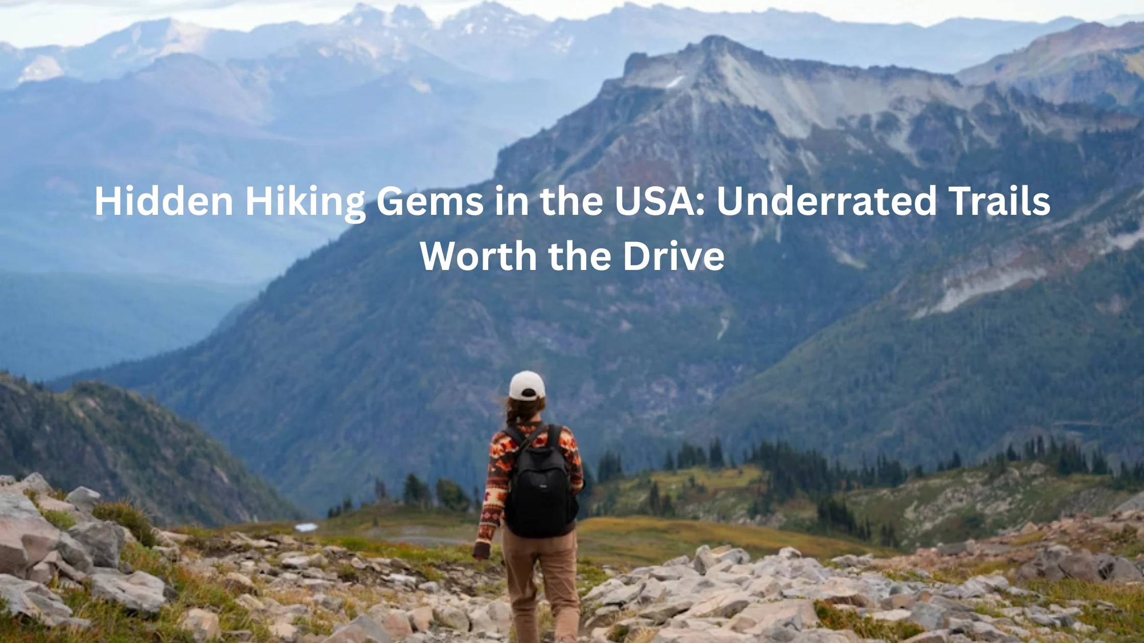
Introduction: You Have Been Hiking the Wrong Trails This Whole Time
Here is a truth nobody tells you when you start getting into hiking. The trails that show up first on every list, every app, every TikTok, and every REI blog post are the ones that also show up on 3 million other people’s itineraries. You drive four hours to Zion, wait in a shuttle line at 6am, hike to Angels Landing surrounded by 400 other people who also found the same blog, and then you post a photo that looks identical to 40,000 other photos of the same viewpoint. Congratulations. You did tourism. But Hiking, the actual experience of moving through landscape that feels like yours for a moment, that happens somewhere else. It happens on the trails nobody has made a viral reel about yet. It happens here.
The West Coast Underdogs: Trails That Slap Harder Than Their Reputation Suggests
The West has Yosemite, Zion, and the Grand Canyon. Everyone knows. Everyone goes. The parking situation at all three has become a genuine personality test. But somewhere between the famous ones and the middle of nowhere, the West also has trails that are objectively spectacular and somehow still under the radar. These are those trails.
1. Opal Creek Wilderness, Oregon
Distance: 9.9 miles round trip. Elevation gain: 700 feet. What it is: An old-growth forest trail leading to a series of turquoise swimming holes that look computer-generated.
Opal Creek sits in the Willamette National Forest in Oregon and it does not appear on most national hiking lists because Oregon already has Crater Lake and the Columbia River Gorge and people seem to think that covers it. It does not cover it. The ancient trees here are massive in a way that recalibrates your sense of scale. The creek runs over moss-covered rocks in a color that genuinely looks like someone turned up the saturation in post-production. The main swimming hole at Jawbone Flats is cold enough to be shocking and beautiful enough that you will not care.
The trailhead is about 26 miles east of Salem. The road in is narrow and unpaved for the last stretch which keeps the casual crowd out. That is a feature. No permit required. No reservation. You just show up and walk into one of the most beautiful forest corridors in the Pacific Northwest.
Trail Tips:
• The road to the trailhead requires a high-clearance vehicle after rain
• Bring a swimsuit, the swimming holes at Jawbone Flats are the payoff
• Old-growth Douglas firs on this trail are over 500 years old
• No camping fees but pack out everything you bring in
• Cell service is essentially zero from the trailhead forward, download offline maps
2. Rogue River Trail, Oregon
Distance: 40 miles point to point, shorter sections accessible. Elevation gain: Moderate rolling terrain. What it is: A multi-day trail through one of the wildest river canyons in the American West.
The Rogue River is famous for whitewater rafting and almost nothing else in the national hiking conversation, which is genuinely baffling because the trail that runs alongside it through the Wild Rogue Wilderness is one of the most stunning long-distance routes in the country. The river canyon walls are dramatic. Black bears and river otters are regular sightings. Several lodges along the route offer beds and meals, which makes this one of the few backcountry experiences where you do not have to carry a week of food on your back.
The section between Grave Creek and Foster Bar is the classic route. You can do it in 4 to 5 days at a comfortable pace. Jet boat shuttles run on the river during summer which can be used to exit the canyon without walking back. This trail has been quietly extraordinary for decades and the hiking community has not fully discovered it yet, which you should treat as a personal invitation.
Trail Tips:
• Permits are required for overnight use, available through recreation.gov
• Lodges along the route including Black Bar Lodge and Marial Lodge accept reservations
• Water from the river requires filtration
• Rattlesnakes are present, watch your step in rocky areas
• The best hiking season is May through June and September through October
3. Coyote Gulch, Grand Staircase-Escalante, Utah
Distance: 12 to 27 miles depending on entry and exit points. Elevation gain: Moderate with significant canyon terrain. What it is: Natural arches, slot canyons, and creek crossings in a landscape that looks like it should cost an admission fee.
Grand Staircase-Escalante National Monument is one of the least visited large public land areas in the country and Coyote Gulch is its crown jewel. The canyon has natural bridges, a natural arch, a waterfall, and miles of meandering creek passage through sandstone walls that glow orange in afternoon light. It is remote in a way that most Utah destinations are not. The trailhead roads are unpaved and require a high-clearance vehicle. There are multiple access points with varying distances. No two people seem to do this trail the same way, which is part of its appeal.
Because this is Bureau of Land Management territory rather than a national park, there are no fees, no shuttle systems, and no visitor center to point you in the right direction. You are expected to know what you are doing or to figure it out. Download the route before you go. Tell someone where you are going. Bring a filter for the creek water. Do all of this and you will have one of the best Hiking experiences available in the American Southwest with a fraction of the crowds of the national parks that border it.
Trail Tips:
• The Hurricane Wash, Red Well, and Fortymile Ridge trailheads are the main access points
• High-clearance vehicles required, some roads are impassable after rain
• Water is available from Coyote Creek but requires filtration
• No permit currently required but check blm.gov for current conditions
• Spring and fall are the best seasons, summer temperatures exceed 100 degrees regularly

The Rocky Mountain and Southwest Trails That Have Been Waiting Patiently for You to Show Up
Everyone who has been to the Rockies can name the same five trails. Everyone. Ask anyone who has visited Colorado and they will mention the same peaks, the same lakes, the same permit lotteries they did not win. What they will not mention is what is between those peaks, which is where the actual undiscovered country lives.
4. Wheeler Peak Trail, Great Basin National Park, Nevada
Distance: 8.6 miles round trip. Elevation gain: 2,900 feet. What it is: A summit hike in one of the least visited national parks in the country, with ancient bristlecone pines along the way.
Great Basin National Park in eastern Nevada is the national park that most Americans do not know exists and that is the entire reason to go. Wheeler Peak at 13,063 feet is the second highest point in Nevada and the trail to reach it passes through a grove of bristlecone pine trees that are among the oldest living organisms on Earth. Some of these trees are over 4,000 years old. They look like something out of a Tolkien illustration and the fact that you can walk among them without a reservation or a two-hour shuttle wait is a minor miracle.
The park also has Lehman Caves, a limestone cavern with stalactites and stalagmites, and some of the best dark sky viewing in the continental United States because eastern Nevada has virtually no light pollution. There is no entrance fee for most areas of the park. The campground requires a reservation in summer. The drive from Las Vegas is about four hours which is long enough that people opt for Red Rock Canyon instead and leave Great Basin entirely to the people who are paying attention.
Trail Tips:
• Acclimatize before attempting the summit if coming from sea level or lower elevation
• Start early to avoid afternoon thunderstorms which are common in summer
• The bristlecone pine grove is accessible as a shorter hike if the summit is too ambitious
• Lehman Caves tours require a ticket, available at the visitor center
• The nearest gas station is in Baker, fill up before entering the park area
5. Ice Lake Basin, Silverton, Colorado
Distance: 8 miles round trip. Elevation gain: 2,600 feet. What it is: A high alpine basin with an electric blue lake that looks fake in every photo and even more unreal in person.
The San Juan Mountains in southwest Colorado are arguably the most beautiful range in the state and Ice Lake Basin is the version of that argument that wins without trying. The lake sits at 12,250 feet and is a specific shade of turquoise blue that comes from glacial minerals in the water. In late July the surrounding meadows have wildflowers so dense that the approach to the lake looks like a painting that someone made up because reality was not interesting enough.
Silverton is the access town and it is a two-hour drive from Durango on one of the most scenic highways in Colorado. The trailhead at South Mineral Campground requires a high-clearance vehicle for the last stretch. Camping at the campground gives you an early start advantage before the day hikers arrive. This trail has been gaining attention on social media over the past few years but the access requirements keep it from reaching full Hanging Lake levels of overcrowding, which means the window to experience it at a reasonable crowd level is still open but not permanently.
Trail Tips:
• South Mineral Campground is the trailhead base, reserve early through recreation.gov
• The last 1.5 miles to the lake involves a steep talus field, trekking poles are helpful
• Peak wildflower season is late July through early August
• Afternoon lightning at this elevation is serious, be off exposed terrain by 1pm
• Fuller Lake is a worthwhile side trip that adds very little distance and a completely different view
6. Buckskin Gulch, Utah
Distance: 21 miles point to point or various shorter options. Elevation gain: Minimal, this is a slot canyon walk. What it is: The longest slot canyon in the world and one of the most surreal walking experiences in the American Southwest.
Buckskin Gulch is what happens when water spends millions of years carving through sandstone and the result is a canyon so narrow that you can touch both walls with your arms outstretched for miles. The walls soar 400 feet overhead. The light that reaches the canyon floor is indirect and orange and makes every photograph look like it was taken on another planet. It connects to Paria Canyon for a longer multi-day route that ends at Lee’s Ferry on the Colorado River.
A permit is required and the canyon is genuinely dangerous after rain because flash floods move through it with no warning. The flood risk is real and should be respected rather than rationalized. Check weather across the entire watershed, not just at the trailhead, before entering. When conditions are right, this is one of the most extraordinary walking experiences available anywhere in the country and the permit system keeps it from being overrun.
Trail Tips:
• Day use and overnight permits available through recreation.gov
• Flash flood risk is serious, check weather 48 hours in advance including upstream
• The Wire Pass trailhead is the standard entry point for day hikes into the upper gulch
• Water is available at Paria River junction but requires filtration
• Wetsuits or waterproof gear may be needed for water passages depending on season
East Coast and Southeast Hidden Gems That Will Make You Wonder Why You Booked That Flight to Utah
The East does not get enough credit in the national Hiking conversation. People write it off because it does not have 14,000-foot peaks or slot canyons and then go stand in line at Bryce Canyon and act like the Appalachians do not exist. The Appalachians have been here longer than the Rockies. They are just more understated about it. That is a personality trait, not a flaw.
7. Linville Gorge Wilderness, North Carolina
Distance: Varies by route, 5 to 12 mile options available. Elevation gain: Significant, 1,500 to 2,000 feet depending on route. What it is: The deepest gorge in the Eastern United States, called the Grand Canyon of the East, and almost nobody outside of the Carolinas knows about it.
Linville Gorge is wild in a way that most Eastern trails are not. The terrain is rugged and the trails are not particularly well-maintained or well-marked, which is either a dealbreaker or the whole point depending on what kind of hiker you are. Table Rock Mountain on the gorge’s eastern rim offers one of the best views in the Appalachians, a panorama across the gorge to Hawksbill Mountain with the river far below. You will not see this view on most hiking apps because most hiking apps have not fully indexed the Linville Gorge and that is a gift.
Camping in the gorge requires a permit on weekends and holidays from May through October. The campsites are primitive. The approach trails are steep. Bears are active. Cell service is nonexistent. This is the version of the East that people who say the East is too tame have simply not found yet.
Trail Tips:
• Weekend permits from May through October available through the Pisgah National Forest office
• Table Rock trailhead is the most accessible starting point for first-time visitors
• Bear canisters or hang systems are required for overnight food storage
• The gorge trail system is not beginner-friendly, come with navigational skills
• Rattlesnakes and copperheads are present, watch your step on rocky terrain
8. Hemmed-In Hollow Trail, Buffalo National River, Arkansas
Distance: 6.5 miles round trip. Elevation gain: 1,200 feet. What it is: A trail to the tallest waterfall between the Rocky Mountains and the Appalachians, in a state that most hikers never think to visit.
Arkansas does not appear on anyone’s hiking bucket list and that is one of the most confusing oversights in American outdoor culture. The Buffalo River corridor is a UNESCO-designated biosphere reserve with bluffs, forests, and river valleys that look nothing like the flat center of the country that people imagine when they think of Arkansas. Hemmed-In Hollow is a 209-foot waterfall that plunges into a natural amphitheater carved into the bluffs above the Buffalo River. It is stunning in a way that feels disproportionate to the reputation of the state it is in.
The trail descends steeply to the hollow and then back up, which means the hard part comes at the end when you are tired. Start early. The trailhead is in the Ponca area of the national river, about 70 miles southeast of Fayetteville. No permit required. No entrance fee. The main barrier to entry is that almost nobody tells you to go to Arkansas for Hiking, and now someone has.
Trail Tips:
• The Compton trailhead off Steel Creek Road is the standard access point
• The descent to the hollow is steep and loose in places, poles are helpful on the return
• The waterfall is most dramatic in spring after rainfall
• Combine with a float trip on the Buffalo River for a full weekend
• Camping at Steel Creek Campground puts you minutes from the trailhead

9. Mount Arab, Adirondack Park, New York
Distance: 1.8 miles round trip. Elevation gain: 740 feet. What it is: A short, steep trail to a fire tower with panoramic Adirondack views that most people drive past on the way to somewhere with a longer line.
The Adirondacks have dozens of trails that are objectively excellent and receive a fraction of the attention of the High Peaks like Marcy and Algonquin. Mount Arab in the southwest Adirondacks is a 1.8-mile round trip hike to a restored fire tower that is open to the public and staffed by volunteers on weekends during summer. The 360-degree view from the tower takes in Tupper Lake, Raquette Lake, and a mosaic of forest and water that goes on in every direction.
The hike is short enough to do before lunch. It is steep enough to feel like you did something. The Adirondack Park is the largest publicly protected area in the contiguous United States and most people know essentially one trail in it. Mount Arab is a genuinely accessible entry point into a park system that rewards exploration more than almost any other in the country.
Trail Tips:
• The trailhead is off Eagle Crag Lake Road near Piercefield, NY
• The fire tower is staffed by volunteer stewards on weekends in summer and fall
• Parking area is small, arrive before 10am on fall foliage weekends
• Bugs in summer are significant, bring insect repellent
• Combine with a swim in one of the nearby Adirondack lakes for a full day
The Midwest and Gulf Coast Trails That Are Out Here Being Incredible With Zero Recognition
The Midwest gets dismissed as flyover country in the hiking world and the people making that dismissal have clearly never stood on a bluff above the Mississippi River in October or walked through a canyon in Missouri that nobody told them existed. These trails are not consolation prizes. They are genuinely excellent and the people who live near them know it, which is why they are not particularly eager to promote them nationally.
10. Pictograph Cave State Park, Montana
Distance: 0.75 miles. Difficulty: Easy. What it is: A short walk to caves containing 2,000-year-old Native American pictographs, surrounded by badlands terrain that looks nothing like what most people picture when they think of Montana.
Montana is famous for Glacier National Park and Yellowstone and both are worth the trip. But Pictograph Cave near Billings is the kind of place that reminds you that extraordinary things are not always at the end of a 10-mile climb. The caves contain over 100 pictographs painted by Indigenous people more than 2,000 years ago. The surrounding landscape is high desert badlands with eroded sandstone formations that feel completely different from the mountain Montana that most tourists see.
The state park is uncrowded even in summer. The trail is short and accessible. The interpretive panels are genuinely good. And the experience of standing in front of art made 2,000 years ago in a landscape that has not changed much since is the kind of thing that resets your perspective in a way that a 14,000-foot summit cannot always replicate.
Trail Tips:
• State park entry fee required, under 10 dollars per vehicle
• The visitor center has excellent context on the pictographs and the archaeology
• The caves are viewable from the trail but visitors do not enter them
• Billings is 8 miles away and has full services including lodging and food
• Combine with Little Bighorn Battlefield National Monument for a history-focused day trip
11. Porcupine Mountains Wilderness State Park, Michigan
Distance: Various, from 2-mile day hikes to the 90-mile Lake of the Clouds Escarpment Trail. Difficulty: Easy to strenuous depending on route. What it is: One of the last stands of old-growth forest in the Midwest, with a lake that turns impossible colors at sunset.
The Porcupine Mountains in the Upper Peninsula of Michigan are the kind of place that makes people from the Midwest feel slightly defensive that they did not know about it sooner. Lake of the Clouds sits in a bowl surrounded by old-growth hemlock and sugar maple forest at the western end of the park. In October the maple canopy turns red and orange and the reflection in the lake is one of the most genuinely spectacular fall foliage views in the country, and it consistently receives less than a tenth of the visitor traffic of the New England foliage destinations.
The park has over 90 miles of trails, a handful of rustic cabins available for reservation, and the darkest skies in the Midwest for stargazing. It requires effort to reach because the Upper Peninsula is simply far from everywhere, which is the whole reason it remains as wild as it does. That distance is the price of admission and it is worth paying.
Trail Tips:
• Lake of the Clouds Escarpment Trail viewpoint is accessible as a very short walk from the parking area
• Rustic cabins bookable through Michigan state parks system, extremely popular and sell out fast
• Fall foliage peaks in early to mid-October depending on the year
• Black bears are present, standard food storage practices apply
• The visitor center at the park entrance has trail maps and current condition updates
12. Ouachita National Recreation Trail, Arkansas and Oklahoma
Distance: 223 miles end to end, shorter sections accessible throughout. Difficulty: Varies by section. What it is: A long-distance trail through the Ouachita Mountains that most American hikers have never heard of and that is one of the best long routes in the South.
The Ouachita Trail runs from Talihina, Oklahoma to Pinnacle Mountain State Park in Arkansas through the Ouachita Mountains, a range that runs east to west rather than north to south like most American mountain chains. The trail passes through national forest, over ridgelines with distant views, and through creek drainages with the specific dense green quality that the South does better than anywhere else in the country.
Most through-hikers who complete it describe the Ouachita Trail as one of the best kept secrets in American long-distance Hiking. The solitude is extraordinary by modern standards. The trail is well-maintained by a dedicated volunteer community. The permit system is minimal. And the culture around it is exactly the kind of low-ego, genuinely welcoming trail culture that the Appalachian Trail used to have before it became a lifestyle brand.
Trail Tips:
• The western terminus at Talihina, OK and eastern at Pinnacle Mountain State Park, AR
• No permit required for most sections, check with Ouachita National Forest for current guidance
• Water sources are reliable in spring and fall, more variable in summer
• The trail crosses several state highways which can serve as resupply access points
• The Ouachita Trail Association maintains a comprehensive guide available at their website
How to Actually Find Hidden Trails Before Everybody Else Does: The Real Approach
Here is the thing about hidden gems. They stop being hidden the moment enough people write blog posts about them. The trails in this list are genuinely underrated right now, in the current moment, and that status is not permanent. The question is how to keep finding these places rather than arriving at the formerly hidden gem after it has acquired a permit lottery and a waitlist.
Stop starting with the apps that everyone uses.
AllTrails is an excellent tool for known, well-documented trails. It is not designed to surface the trails that do not have a hundred reviews yet. For finding genuinely underused trails, look at USDA Forest Service district maps, Bureau of Land Management recreation maps, and state parks systems. These sources contain thousands of trails that never make it onto the crowdsourced apps because not enough people have rated them yet.
Talk to local outdoor clubs and ranger stations.
Every region has trail running clubs, hiking groups, and paddling organizations whose members know exactly which trails are worth doing and which ones are oversold. A 10-minute conversation with a ranger at a district visitor center will give you better trail recommendations than three hours of internet research because rangers know what is happening on the ground right now and they are usually delighted to talk about it.
Look at Bureau of Land Management and National Forest lands, not just national parks.
National parks contain roughly 4 percent of America’s protected public land. National forests, BLM land, wilderness areas, national monuments, and state parks make up the rest. Most of the under-the-radar trails in this country are on non-national park public land where management is lighter, regulations are fewer, and the crowds have not yet arrived. Learning to navigate recreation.gov and the BLM’s website opens up a completely different map of the country.
Develop a high-clearance vehicle or a willingness to walk the extra distance.
A significant number of the best undiscovered trails in the West are inaccessible to standard passenger vehicles. The trailheads require an unpaved road that most rental cars cannot manage. This is not an accident. This is the mechanism by which certain places remain uncrowded. A high-clearance vehicle, or the willingness to park early and walk the extra mile to a trailhead, unlocks a different level of the country. Most people are not willing to do this. That unwillingness is your advantage.
Go in the shoulder season.
September and October are generally the best months to visit popular trails in terms of crowd levels, and May and early June are second best. The difference in the experience of a trail in peak season versus a month before or after is significant enough that the same trail effectively becomes two different places. Go in October instead of August. Go in May instead of July. Show up on a Tuesday. These are the simplest tactics and they work.
Conclusion: You Now Have a List. The Question Is Whether You Use It.
You have spent a non-trivial amount of time reading about trails you have not been to yet. That is either research or procrastination and only you know which one it is. The good news is that every single trail on this list is accessible, real, and waiting with the particular patience that landscapes have. Pick one. Drive to it. Get out of the car. The undiscovered version of American Hiking is not a myth or a throwback to a simpler era. It is just slightly further from the parking lot than most people are willing to go. That distance is your entire competitive advantage. Use it.

Rubie Rose is the founder of Park Trails Guide. As a USA resident and nature lover, she is dedicated to creating helpful national park guides using official sources and real visitor experiences. Her mission is to make planning trips to places like Yosemite, Grand Canyon, and Zion easier for families, beginners, and travelers.