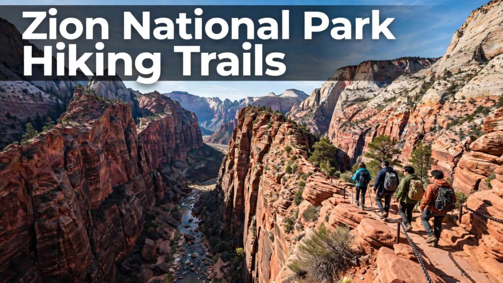
Zion National Park Hiking Trails: Complete Guide to the Best Hikes (2026)
Zion National Park is one of the best places in Utah for hiking, with trails ranging from easy paved walks along the Virgin River to demanding routes involving steep climbs, exposed cliffs, and river crossings.
The most famous Zion hikes include Angels Landing, The Narrows, Emerald Pools, Watchman Trail, Canyon Overlook, and Riverside Walk. But you don’t need to tackle the hardest trails to enjoy the park. There are several shorter hikes with excellent canyon views that work well for families, beginners, and visitors with limited time.
This guide covers the best Zion National Park hiking trails for 2026, including distance, difficulty, elevation gain, trailhead or shuttle stop, permits, and what to expect.
2026 update: Trail conditions and closures can change. Check Zion National Park’s official current conditions before starting your hike. The National Park Service currently lists long-term closures for Hidden Canyon and Observation Point via the East Rim Trail from Weeping Rock because of rockfall.

Best Zion National Park Hiking Trails at a Glance
| Trail | Distance | Difficulty | Approx. Elevation Gain | Permit |
|---|---|---|---|---|
| Angels Landing | 5.4 mi round trip* | Strenuous | ~1,500 ft* | Yes |
| The Narrows | Up to 9.4 mi round trip | Strenuous | 334 ft | No, bottom-up |
| Watchman Trail | 3.3 mi | Moderate | 368 ft | No |
| Canyon Overlook | 1 mi | Moderate | ~154 ft | No |
| Emerald Pools | Varies | Easy–Moderate | Varies | No |
| Riverside Walk | 2.2 mi | Easy | 57 ft | No |
| Pa’rus Trail | 3.5 mi | Easy | 50 ft | No |
| Scout Lookout | 4.2 mi | Strenuous | 1,000 ft | No* |
*The Angels Landing figures include the approach to Scout Lookout; the final 0.5-mile section from Scout Lookout to Angels Landing requires a permit. NPS describes the Scout Lookout route as 4.2 miles round trip with 1,000 feet of elevation gain.
1. Angels Landing
Difficulty: Strenuous
Distance: About 5.4 miles round trip to Angels Landing
Elevation gain: About 1,500 feet
Trailhead: The Grotto, Shuttle Stop #6
Permit: Required for Angels Landing
Time: Several hours for most hikers
Angels Landing is the hike most closely associated with Zion National Park. The route climbs steeply from The Grotto through Refrigerator Canyon and up Walter’s Wiggles before reaching Scout Lookout.
From Scout Lookout, the final section follows a narrow ridge with chains installed along exposed sections of the trail.
The National Park Service warns that some sections are only a few feet wide and have significant drop-offs. Everyone continuing from Scout Lookout to Angels Landing needs a permit.
The 2026 permit system includes seasonal and daily opportunities through Recreation.gov. The NPS lists a $6 application fee and, if awarded, $3 per person.
Can you hike Angels Landing without a permit?
You can hike to Scout Lookout without an Angels Landing permit. However, you cannot continue onto the Angels Landing chained section without the required permit.
Scout Lookout itself provides impressive views and is a challenging hike, making it an alternative if you don’t have an Angels Landing permit.

2. The Narrows
Difficulty: Strenuous
Distance: Up to 9.4 miles round trip from the bottom
Trailhead: Temple of Sinawava, Shuttle Stop #9
Permit: Not required for bottom-up hiking
Terrain: Virgin River
The Narrows is completely different from a traditional hiking trail. Instead of following a dry path, you’ll spend much of the hike walking and wading through the Virgin River between towering canyon walls.
For the bottom-up route, you first walk approximately one mile along the paved Riverside Walk from the Temple of Sinawava. At the end, the trail enters the river.
The National Park Service says hikers can travel upstream as far as Big Spring, creating a 9.4-mile round trip. At least 60% of the route can involve walking, wading, and sometimes swimming in the river.
You don’t have to hike all the way to Big Spring. Many visitors simply enter the canyon, walk upstream for a while, and turn around.
Is The Narrows safe?
The Narrows requires careful planning. Water levels, weather, cold water and flash-flood potential can affect whether the hike is appropriate.
The NPS specifically warns that flash floods can occur and recommends checking current conditions and weather forecasts before entering the canyon.
For the bottom-up route, a wilderness permit is not required, but that does not mean the hike is risk-free.
3. Watchman Trail
Difficulty: Moderate
Distance: About 3.3 miles round trip
Elevation gain: About 368 feet
Trailhead: Zion Canyon Visitor Center
Permit: No
Watchman Trail is a good option if you want a scenic Zion hike without committing to the length or exposure of Angels Landing.
The trail climbs above the Zion Canyon Visitor Center and finishes at a viewpoint overlooking the Towers of the Virgin, lower Zion Canyon, and Springdale.
The official 2026 information guide lists approximately 3.3 miles and 368 feet of elevation gain.
Because the trail begins close to the visitor center, it’s also convenient for visitors who want a hike that doesn’t require going deep into Zion Canyon.
4. Canyon Overlook Trail
Difficulty: Moderate
Distance: 1 mile round trip
Elevation gain: About 154 feet
Location: East Side of Zion
Permit: No
If you’re looking for a relatively short hike with a big payoff, Canyon Overlook Trail is one of the most convenient options.
The trail starts near the east entrance of the Zion-Mount Carmel Tunnel and climbs over sandstone terrain to a viewpoint overlooking Zion Canyon.
The NPS describes it as a 1-mile round-trip moderate hike with a viewpoint toward the Towers of the Virgin and surrounding canyon.
One thing to remember is that parking at the trailhead is extremely limited. You may need to try more than once to find a space.

5. Emerald Pools Trails
Difficulty: Easy to Moderate
Location: Zion Lodge, Shuttle Stop #5
Permit: No
The Emerald Pools area includes several interconnected trails and is one of the classic hiking destinations in Zion Canyon.
The routes include:
- Lower Emerald Pool
- Middle Emerald Pools
- Upper Emerald Pool
- Kayenta Trail
The Middle Emerald Pools Trail climbs to sandstone ledges and pools above the Lower Emerald Pool. The NPS currently describes it as a moderate hike with moderate drop-offs.
The 2026 park guide lists the Middle Emerald Pools route at approximately 2.2 miles and 150 feet of elevation gain, while the Upper Emerald Pool Trail is approximately 1 mile with 200 feet of elevation gain.
Important Emerald Pools rule
Do not swim in the Emerald Pools. The NPS identifies these pools as important water sources for wildlife and instructs visitors not to enter them.
6. Riverside Walk
Difficulty: Easy
Distance: 2.2 miles round trip
Elevation gain: About 57 feet
Trailhead: Temple of Sinawava, Shuttle Stop #9
Permit: No
Riverside Walk is an excellent choice if you want to experience Zion Canyon without a strenuous climb.
The paved trail follows the Virgin River through a dramatic section of Zion Canyon. The route eventually reaches the entrance to The Narrows.
The 2026 park information guide lists the hike at approximately 2.2 miles round trip, with about 57 feet of elevation gain.
It’s also an important part of the bottom-up Narrows experience because hikers use Riverside Walk to reach the river.
7. Pa’rus Trail
Difficulty: Easy
Distance: 3.5 miles round trip
Elevation gain: About 50 feet
Location: Visitor Center to Canyon Junction
Permit: No
Pa’rus Trail is one of the easiest ways to enjoy Zion scenery.
The paved trail follows the Virgin River between the Zion Canyon Visitor Center and Canyon Junction. The NPS describes Pa’rus as accessible to wheelchairs, suitable for leashed pets, and open to bicycles.
The trail also offers views of the Watchman and is a popular location for sunset, stargazing and photography.
For visitors who aren’t looking for a steep mountain hike, Pa’rus is a useful addition to a Zion itinerary.

8. Scout Lookout
Difficulty: Strenuous
Distance: 4.2 miles round trip
Elevation gain: 1,000 feet
Trailhead: The Grotto, Shuttle Stop #6
Permit: No for Scout Lookout
Scout Lookout is reached via the West Rim Trail and is the stopping point immediately before the Angels Landing chains.
You still get a substantial Zion hiking experience without continuing onto the permit-required Angels Landing section.
According to the NPS’s 2026 information guide, the Scout Lookout route is approximately 4.2 miles round trip, with 1,000 feet of elevation gain and an average hiking time of around three hours.
The route has long drop-offs and is not recommended for young children or people uncomfortable with heights.
Zion Hiking Trails Map and Shuttle Stops
Understanding the shuttle system makes planning Zion hikes much easier.
During the shuttle season, private vehicles aren’t allowed on the Zion Canyon Scenic Drive. The free Zion Canyon shuttle connects the Visitor Center with major destinations including Zion Lodge, The Grotto and the Temple of Sinawava.
Some useful stops are:
| Shuttle Stop | Hiking Area |
|---|---|
| Stop #1 | Visitor Center / Watchman |
| Stop #5 | Zion Lodge / Emerald Pools |
| Stop #6 | The Grotto / Angels Landing / Scout Lookout |
| Stop #9 | Temple of Sinawava / Riverside Walk / The Narrows |
For September 13–October 24, 2026, the NPS schedule lists the first Zion Canyon shuttle from the Visitor Center at 7:00 a.m. and the last shuttle leaving the Visitor Center at 6:00 p.m. The last shuttle from the Temple of Sinawava is scheduled for 7:15 p.m.
Schedules can change, so check the official NPS shuttle page before your hiking day.
Best Zion Hikes for Different Types of Visitors
Instead of choosing a trail based only on popularity, consider what type of hike you want.
Best for an iconic adventure
Angels Landing — challenging, exposed and permit-required.
Best for a unique hiking experience
The Narrows — river hiking through a spectacular slot canyon.
Best short scenic hike
Canyon Overlook Trail — only about one mile round trip.
Best moderate hike near the Visitor Center
Watchman Trail — canyon and Springdale views without traveling deep into Zion Canyon.
Best easy canyon walk
Riverside Walk — paved and relatively flat.
Best accessible trail
Pa’rus Trail — paved with minimal elevation gain and designated accessibility features.
Best alternative to Angels Landing
Scout Lookout — strenuous but doesn’t require the Angels Landing permit.
Best for pools and waterfalls
Emerald Pools — several interconnected routes with different difficulty levels.
What to Bring for Hiking in Zion
Conditions in Zion can vary considerably depending on the season, elevation and trail.
For most hikes, consider bringing:
- Plenty of drinking water
- Comfortable hiking shoes
- Sun protection
- Hat and sunglasses
- Snacks or food
- Lightweight layers
- Navigation/map
- First-aid supplies
- Headlamp or flashlight if hiking late
- Trekking poles for suitable trails
For The Narrows, preparation is particularly important because you’ll be walking through the Virgin River over slippery, uneven rocks. The NPS recommends closed-toe footwear and a walking stick for the Narrows.
Zion Hiking Safety Tips for 2026
Zion’s trails range from easy paved paths to exposed and strenuous routes, so choose a hike appropriate for your experience and physical ability.
Before leaving:
- Check current trail conditions.
- Check the weather forecast.
- Check for flash-flood warnings before The Narrows.
- Carry enough water and food.
- Start early for longer hikes.
- Stay on designated trails.
- Don’t enter closed areas.
- Follow posted signs and ranger instructions.
- Give other hikers space on narrow sections.
- Know when to turn around.
The National Park Service emphasizes that visitors are responsible for their own safety and advises hikers to check current conditions before starting.
Frequently Asked Questions
What is the most famous hike in Zion National Park?
Angels Landing is one of Zion’s most famous hikes. The final section from Scout Lookout requires a permit and involves a steep, narrow ridge with chains and substantial exposure.
Do you need a permit to hike in Zion?
Not for most popular day hikes. However, a permit is required to continue to Angels Landing from Scout Lookout, while the bottom-up Narrows route from the Temple of Sinawava does not require a wilderness permit.
How difficult is hiking The Narrows?
The Narrows is considered strenuous because much of the hike takes place in the Virgin River. Water depth, current, slippery rocks and weather can significantly affect conditions.
What is the easiest hike in Zion?
Pa’rus Trail and Riverside Walk are among the easiest popular Zion Canyon hikes. Both are paved, although conditions and accessibility can vary along different sections.
Can beginners hike in Zion National Park?
Yes. Zion has hikes for different experience levels. Beginners can start with trails such as Pa’rus Trail, Riverside Walk or other shorter routes before attempting strenuous hikes such as Angels Landing or The Narrows.
Is Angels Landing safe for beginners?
Angels Landing is a strenuous hike with narrow and exposed sections. The National Park Service specifically warns hikers about steep drop-offs and recommends extreme caution. Beginners should carefully consider the terrain, weather and their own hiking experience before attempting it.
Is Observation Point open in 2026?
The current NPS conditions page lists Observation Point via the East Rim Trail from Weeping Rock as a long-term closure because of a large rockfall. Always check current conditions before planning a route to Observation Point because access can change.
Final Thoughts
Zion National Park has a hiking trail for almost every type of visitor. You can spend a few hours walking along the Virgin River on Pa’rus Trail or Riverside Walk, climb to the viewpoints on Watchman Trail or Canyon Overlook, or take on more demanding adventures such as Angels Landing and The Narrows.
For a first visit, it’s worth combining different types of trails rather than focusing only on the most famous hike. A short scenic trail can give you a completely different experience from a strenuous climb or river hike.
Most importantly, check Zion’s current conditions, weather and trail closures before your hike. Conditions can change, particularly on The Narrows and other trails affected by rockfall, flooding or seasonal conditions.
Official source: Zion National Park – Hiking in Zion
Also See: Where to Stay in Zion National Park: Best Areas & Hotels for 2026
Pingback: Zion National Park Weather: Monthly Temperatures, Rain & Best Time to Visit - Park Trails Guide